Distributors should unplug the Earth imagery bottleneckby Nicholas Borroz
|
| The issue with Earth imagery is that a bottleneck prevents analytics firms from developing their services. |
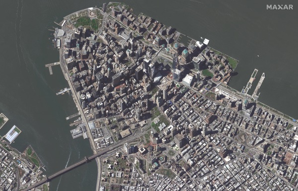
There already exist many satellites that provide Earth imagery. Some imagery is free, notably that provided by the European Space Agency’s Sentinel satellites. Free satellite imagery does not have the highest resolution, nor does it have the quickest refresh rates, though often it is sufficient to provide valuable analytics services. If analytics firms are willing to pay, however, then they can access imagery from private providers like Planet, which offer higher resolution and quicker refresh rates. Satellites also vary in terms of the wavelength ranges across the electromagnetic spectrum they can see: satellites can see in the visible ranges like humans, and beyond in both directions, into infrared and ultraviolet, for instance.
Analytics companies can take this Earth imagery and process it in various ways to provide valuable services. If, for instance, you are a farmer who would like to get a better sense of your harvest next season, analytics firms can help with that. They can analyze imagery of your field and look at specific spectral indices, which compare various wavelength ranges. A common index for agricultural services, for instance, is NDVI, which compares wavelengths that are absorbed and reflected by plant matter to give estimates on biomass. Analyzing trends in how spectral indices change over time, combined with analyses of other data, results in powerful insights that agriculturalists can use to get an upper edge in terms of farm management. There are similar services to be had monitoring other phenomena, such as traffic, pollution, and fires.
Such analytics services are attractive in these economically lean times because there is no need to develop new infrastructure. The data already exists and, in fact, is abundant. There is also obvious demand for analytics services from customers outside the space sector, such as farmers. These two factors—no need for new infrastructure and clear demand—make Earth imagery analytics services an obvious area for near-term growth, more so than business in other areas of the space sector where profitability is less certain. The profitability of developing a new launch vehicle, for instance, depends on securing regular demand from satellite operators. Will there be enough demand to allow launch vehicle developers to recoup their costs? There is no clear answer to this question.
The issue with Earth imagery is that a bottleneck prevents analytics firms from developing their services. There is no shortage of Earth imagery, but there are limitations in terms of distribution bandwidth that hinder analytics firms’ accessing it. Distribution is not a particularly exciting business area, but it is an important intermediary step that connects Earth imagery to analytics.
Unlike analytics firms, which produce application-specific information products, distributors transform raw data into the information that analytics firms use. For analytics firms to be able to focus on developing and selling their services, they must be able to access data of a certain quality (e.g. imagery not interrupted by cloud cover.) They must be able to use data from a variety of satellites or constellations, and this various data must be normalized in terms of being quickly comparable in terms of time and location. Analytics firms must furthermore be able to buy only the data that they need. They may also, depending on their analytics services, desire access to imagery already refined into certain spectral indices.
This is not to say that analytics firms cannot do all these tasks in-house. To the contrary, analytics firms can develop relations with imagery providers, they can normalize data, they can clean data, they can purchase only the data they need, and they can refine data into specific spectral indices. But all these activities cost time and money. It makes more sense to outsource. Just as is the case in any industry, firms outsource certain tasks to partners because it makes sense to do so. It is cheaper to pay someone else to do other tasks and focus on your area of specialization (in this case, creating analytics services that are based on Earth imagery.)
| For businesspeople seeking to advance the space sector and also to make profit, distribution is a worthy area of focus. |
Conversely, it also makes sense from the imagery providers’ perspective to work with distributors as opposed to analytics firms. This is because there are hundreds of analytics firms in a wide variety of application areas. The imagery providers (e.g. Planet) do not have time to deal with all the analytics firms, negotiating deals with each of them to purchase particular datasets. It is easier instead to deal with a smaller number of distributors, who then parcel out usable information to the analytics firms. (Incidentally, sometimes there is overlap in business areas: Planet, for instance, is both an imagery provider and also has its own analytics services.)
A useful parallel is the oil industry, which has three segments: upstream (extracting crude oil); midstream (transporting crude oil to refineries); and downstream (refining crude oil and selling petroleum products.) In the Earth observation industry, there is a significant amount of both upstream and downstream activity (i.e. imagery provision and analytics services), but there is a shortage of midstream activity (i.e. distribution.)
The Earth imagery industry holds great promise in these difficult economic times. Unlike other more speculative areas of the space sector, analytics firms meet obvious demand and their profitability does not depend on further infrastructure development. Distribution, though, is a bottleneck that prevents this opportunity from realizing itself. For businesspeople seeking to advance the space sector and also to make profit, distribution is a worthy area of focus.
Note: we are temporarily moderating all comments submitted to deal with a surge in spam.
