An analysis of Chinese remote sensing satellitesby Henk H.F. Smid
|
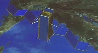
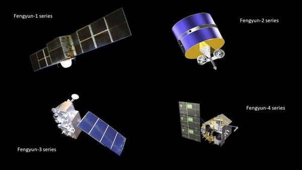 Four types of Fengyun meteorological satellites. (credit: CMA/SCS) |
Haiyang Ocean Satellite (HY)
Haiyang are a group of marine scientific remote sensing satellites developed by Chinese Academy of Space Technology (CAST) and operated by the National Satellite Ocean Application Service, a subordinate agency of the State Oceanic Administration. The spacecraft use the three-axis stabilized CAST968 platform. The HY 1 series [2002, 2007, 2018, 2020] is China’s first satellite for surveying ocean resources (ocean color and sea surface temperature) and monitoring the environment. The HY 2 series [2011, 2018, 2020, 2021], is a parallel series to HY 1. HY 2 monitors the dynamic ocean environment with microwave sensors. It detects sea surface wind field, sea surface height, and sea surface temperature. Sensors are an altimeter, a scatterometer, and a microwave imager. HY 3 satellites, still to be launched, will be used to monitor islands, coastal zones, and maritime targets to obtain ocean geodesy information with optical, infrared and microwave sensors.
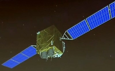
 Haiyang 1 marine scientific remote sensing satellite. (credit: NSOAS) |
 Haiyang 2 research of dynamic ocean environment. (credit: CAST) |
Huanjing Disaster and Environmental Monitoring Satellite (HJ)
China plans to launch a total of 11 Huanjing satellites for disaster and environmental monitoring. The satellites will have visible, infrared, and multi-spectral sensors, and synthetic aperture radar (SAR). Up until now, five satellites have been launched. The first two satellites, HJ 1A/B, were launched simultaneously in 2008 in a coplanar orbit with a phasing of 180 degrees and were optical imaging satellites. HJ 1C, that was launched in 2012, is the first civilian Chinese remote sensing satellite to use a SAR radar. This S-band SAR was manufactured in Russia by NPO Mashinostroyeniya. In 2020, HJ 2A/B were launched and probably are improved satellites that will replace HJ 1A/B.
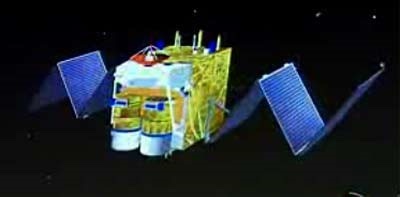
 Huanjing 1 Disaster and Environmental Monitoring Satellite. (credit: CAST) |
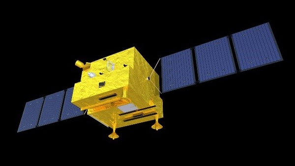
Ziyuan/CBERS Earth Resources Satellite (ZY)
The Ziyuan I/CBERS program integrated a 1970s plan to develop Brazilian and Chinese economies through major projects by promoting the use of space. Ziyuan I/CBERS satellites were designed for global coverage and include optical cameras and a system for collecting data on the environment. They are jointly managed by the PRC and Brazil. From 1999 to 2019, four successful CBERS missions were flown; three more ZY missions were launched in which China did not cooperate with Brazil.
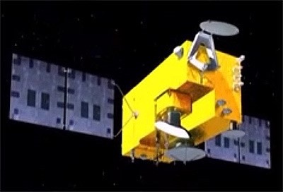
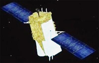
Ziyuan II was billed as a civilian Earth observation system, but was militarily codenamed Jianbing-3 and was China’s first [2000] military high-resolution digital remote sensing satellite. They are reportedly used for area surveillance.
Ziyuan III is China’s first high-resolution civilian stereoscopic Earth observation program and has the overall goal of creating large-scale, three-dimensional maps and “providing relevant parameters for environmental monitoring, resource management, disaster response, urban planning and national security”.
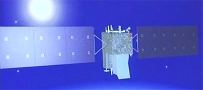
 CBERS-4 or Ziyuan I-04 Earth resources satellite. (credit: INPE) |
 Ziyuan II Earth resources satellite. (credit: CAST) |
China High-resolution Earth Observation System (CHEOS)
In 2006, CHEOS was established as one of sixteen major national science and technology projects. Proposed was to build a high-resolution Earth observation system based on satellites, stratospheric airships, and aircraft. The associated ground systems would be improved or developed. The combination of these measures had to provide an all-weather, all-time, and global Earth observation capability. CHEOS therefore, should have multi-observation capabilities to provide high spatial-, temporal- and spectral resolution properties. From 2013 on, Gaofen satellites were launched to create the satellite-based part of CHEOS.
Gaofen [high resolution] Earth observation satellite (GF)
For the CHEOS program, more than 25 Gaofen satellites have been launched since 2013. These satellites are based on CAST satellite busses. It is known from the first seven GF series that different sensors are often used on each satellite. For example, GF 1, 2, 4, and 6 have high-resolution cameras and GF 3 is equipped with a C-band SAR. GF 5 has six sensors, including a hyperspectral camera and a directional polarization camera. The extra laser altimeter system on GF 7 enables three-dimensional research. Resolution capabilities and other information about Gaofen satellites was published for the lower numbered Gaofen series of satellites. Information for Gaofen satellites with number 8 and higher has not been publicly released, suggesting that the satellites are (partly) for national defense purposes.
 Deployed GF 1 spacecraft. (credit: www.cheos.org.cn) |
 Deployed GF 1 spacecraft. (credit: www.cheos.org.cn) |
Gaofen satellites [SCS, August 1, 2022]
| Satellite | Year of Launch | Function/Sensors |
|---|---|---|
| Gaofen 1 series | 2013, 2018 | 2 HR (2m Pan, 8m MS) and 4 WFV (16m MS) camera’s |
| Gaofen 2 | 2014 | 2 Identical cameras with 0.8m Pan, 3.2m MS |
| Gaofen 3 series | 2016, 2021, 2022 | High Resolution SAR (Synthetic Aperture Radar) |
| Gaofen 4 | 2015 | HR camera’s in geostationary orbit |
| Gaofen 5 series | 2018, 2021 | 6 Different sensors for atmospheric observations |
| Gaofen 6 | 2018 | Multispectral sensors with high spatial resolution |
| Gaofen 7 | 2019 | 2 High resolution camera’s with a coupled laser altimeter |
| Gaofen 8 | 2015 | High resolution optical imaging payload |
| Gaofen 9 series | 2015, 2020 (4) | High resolution payload for urban planning |
| Gaofen 10 | 2016, 2019 | Unknown |
| Gaofen 11 series | 2018, 2020, 2021 | Optical camera’s with high spatial resolution, military? |
| Gaofen 12 series | 2019, 2021, 2022 | High Resolution SAR (Synthetic Aperture Radar) |
| Gaofen 13 | 2020 | HR camera’s in geostationary orbit |
| Gaofen 14 | 2020 | Electro-optical stereo cartography |
| Gaofen DUOMO | 2020 | Optical payload with sub-meter resolution |
Commercial remote sensing satellites
Beijing series of commercial optical remote sensing satellites
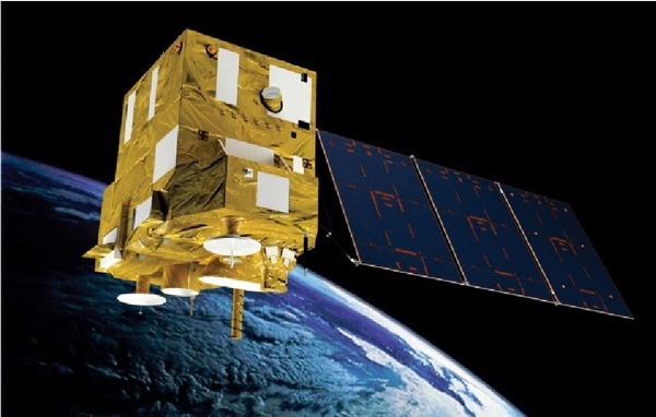
Beijing 1 [2005] and constellation satellites Beijing 2 [2015, 2018] were commercially built for China by Surrey Satellite (UK). Noteworthy, the imaging capacity of Beijing 2 was 100% leased by a Singapore based company. Beijing 3 [2021, 2022] satellites have been built by China Aerospace Science and Technology Corporation to acquire optical remote sensing satellite data and information products for the global commercial market. Beijing 3 satellites will mainly be used to provide remote sensing services in the fields of land resources management, agricultural resources survey, environment monitoring and city applications.
 Beijing 3 commercial optical remote sensing satellite. (credit: China-Arms.com) |
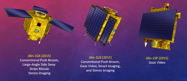
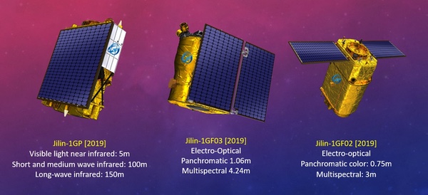
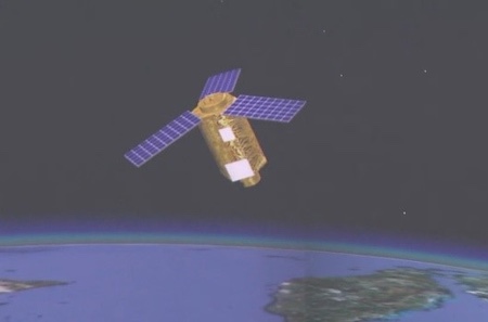
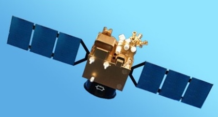
Jilin-1 series of satellites
Jilin-1 is China’s first, self-developed, commercial remote sensing satellite system and is operated by the Chang Guang Satellite Technology Corporation (CGSTC). The Jilin-1 satellite constellation is the core project and will eventually be composed of 138 remote sensing satellites covering high resolution, large swath width, video, and multi-spectrum, and a high revisit commercial service. As of the beginning of September, CGSTC has successfully launched 73 Jilin-1 satellites into space. The completed Jilin-1 constellation will be able to visit any place in the world 15 to 17 times per day, with the ability to update a global map every year and a national map five times per year. It can provide “high-quality remote sensing information and product services for agricultural and forestry production, environmental monitoring, smart city, geographical mapping, land planning and other fields”.
 1st Generation Jilin-1 remote sensing satellites. (credit: CGSTC/SCS) |
The first generation of Jilin-1 satellites were put in orbit in 2015, the second generation in 2019. A batch of eight Jilin-1 satellites (one Wideband 01C and seven Gaofen 03D spacecraft) were put in orbit on May 5, 2022. The Wideband 01C satellite is a 230-kilogram spacecraft featuring a high resolution video capability. The payload provides a 0.5-meterresolution optical as well as a 2-meter resolution multi-spectral capability. The seven 40-kilogram Gaofen 03D high-resolution imaging satellites in this launch provide better than a 0.75-meter resolution optical as well as a 2-meter resolution multi-spectral capability. The last batch, August 10, 2022, consisted of 16 Jilin-1 imaging satellites: ten in the Jilin-1 Gaofen high resolution optical imaging series and the first six in the Jilin-1 Hongwai A (infrared imaging) series.
 2nd Generation Jilin-1 remote sensing satellites. (credit: CGSTC/SCS) |
Comprehensive information on Jilin-1 satellites can be obtained from the CGSTC website.
Military remote sensing satellites
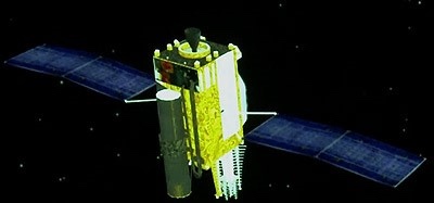
Yunhai meteorological satellite (YH)
Yunhai 1 is a meteorological satellite series [2016, 2019] in Sun-synchronous orbits (SSO), according to state media used for “detecting the atmospheric and marine environment and space environment, as well as disaster control and other scientific experiments.” The Yunhai series are assessed to have military purposes. Yunhai 1 satellites have been built by the Shanghai Academy of Spaceflight Technology, possibly based on the CAST2000 platform. Data provided by the Yunhai 1 satellites complement the information provided by the civil Fengyun meteorological satellites. Yunhai 1-02 [2019] suffered a breakup event on March 18, 2021, probably after an accidental collision with space debris.
Yunhai 2 is a constellation of military meteorological satellites. The satellites reportedly use Global Navigation Satellite System radio occultation to collect atmospheric data for weather forecasting and for ionosphere, climate, and gravity research. A first cluster of six identical Yunhai 2 satellites was launched in December 2018 in an 800-kilometer circular orbit at 50 degrees inclination together with a Hongyan 1 prototype communications satellite.
Ludi Kancha Weixing (LKW)
Ludi Kancha Weixing is a high-resolution optical Earth observation satellite for military purposes. Chinese media have stated that the satellites are used for remote sensing exploration of land resources. However, the secrecy surrounding the satellites is extreme, even by Chinese standards, giving credence to the theory that they are part of the country’s military topographical (the name means Land Survey Satellite) reconnaissance efforts. Looking at its parameters, the LKW satellites appear to be connected to the Yaogan reconnaissance satellite fleet. Based on its appearance—a hexagonal satellite body with three radial fixed solar panels—the satellite is likely suitable for hosting a telescope of about 65 centimeters and thus, in a 500-kilometer orbit, achieving a possible ground resolution of up to 0.7 meters for panchromatic and better than 3 meters for multispectral and near-infrared images. In 2017 and 2018, two satellites were launched into space. The rapid deployment pace of these four satellites are previously only seen in military-operated satellite projects.
 Ludi Kancha Weixing Land Survey Satellite. (credit: CCTV) |
Tianhui Yi Hao Weixing
Tianhui is a collective name for a network of several topographical satellites, built by Dong Feng Hong and operated by the People’s Liberation Army. It includes Earth observation missions using optical, radar, gravity, and magnetism sensors to obtain geo-information about the Earth. The program provides for the launch of nine satellites of six different types to obtain quantitative research of the Earth’s land, sea, gravity and magnetic field. These satellites will form a space-based Earth observation network to conduct both basic Earth survey and detailed survey for key areas or in response to an emergency.
Tianhui 1 satellites are part of the Ziyuan program which includes several civilian and military remote sensing programs. Four satellites of this type have been launched (2010–2021) in 500-kilometer SSO. The satellites are equipped with two different camera systems. One of them in the visible range (5 meters resolution), and the other in the infrared band (10 meters resolution).
 Tianhui 1 topographical satellite. (credit: CAST) |
Tianhui 2 satellites will be used, according to state media, to conduct land surveys, mapping, and scientific experiments in space. The Tianhui 2 series is the first microwave measurement system for China to use interferometric synthetic diaphragm radar (InSAR) technology, working together in pairs. (The satellite system is probably similar to the German TanDEM-X satellite system.) The Tianhui 2 satellites are believed to operate in the X-band and have a resolution of 3 meters. The first group of two satellites was launched in 2019. The mission was not announced in advance by China and NOTAM’s for the launch were not sent. The pair of Tianhui 2 satellites have been launched in almost the same type of orbit, 500-kilometer SSO, as the four Tianhui 1 satellites.
There is no Tianhui 3 satellite as of now. The Tianhui 4 satellite (2021) will, reportedly, observe the Earth in both the visible and infrared spectrum using two cameras with a resolution of less than 5 meters. It has been built by the Dong Feng Hong Corporation/CAST and is operated by the People’s Liberation Army.
 Possible Tianhui 2 topographical satellites. (credit: CCTV-4) |
Tongxin Jishu Shiyan Weixing (TJS)
Tongxin Jishu Shiyan (Weixing) are a series of Chinese satellites that have been deployed in geostationary orbit since 2015 and presented by Chinese authorities as telecommunications satellites. Specific features have not been published and the real purpose of each satellite is therefore questionable. The behaviors exhibited by these satellites indicate a mixture of applications though. All TJS satellites are in geostationary orbit (GEO). Some appear to be built for missile warning (built by the Shanghai Institute of Satellite Engineering), while others seem to operate like signal intelligence satellites (built by CAST, a Beijing based satellite factory). According to the Shanghai Academy of Spaceflight Technology, TJS 6 and TJS 7 have experimental docking stations. In any case, by Western observers they are considered to be military satellites because of the limited information available and the lack of published outcomes. It cannot be said with any certainty what kind of (military) satellites the launched TJS 3 and TJS 7 (2018, 2021) are. There seems to be no TJS 8.
TJS 1, 4, and 9 (2015, 2019, 2021) are assessed to be electronic intelligence (ELINT) satellites. They are sometimes also referred to as Qianshao-3 or Chang Cheng. Reportedly, TJS 1 had successfully deployed China’s first large aperture reflector antenna (about 32 meters across) after it reached GEO.
TJS 2, 5, and 6 (2017, 2020, 2021) are assessed to be early warning of ballistic missiles satellites. They are sometimes also referred to as Huoyan. The name Huoyan means Fire Eyes that may suggest infrared sensors.
 TJS 4 Probable ELINT satellite (Reflector not deployed). (credit: CCTV) |
 TJS 5 Probable Early Warning satellite. (credit: SAST) |
Jianbing Military Remote Sensing Satellites
Chinese military reconnaissance satellites are usually categorized based on their military Jianbing (group) designation. The first Jianbing group were the first generation of Fanhui Shi Weixing photo reconnaissance satellites (1975). The first Yaogan satellite, as most military remote sensing satellites have been publicly called since 2006, was the first of the Jianbing 5 group. Since 2015, the Jianbing-Yaogan relationship is no longer very clear and Western analysts differ on this naming. Yaogan satellites primarily support the People’s Liberation Army and may support civil causes too. They utilize various means of remote sensing: synthetic aperture radar (SAR), electro-optical reconnaissance (EO), and electronic intelligence (ELINT) for ocean surveillance.
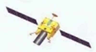
Fanhui Shi Weixing (FSW)
The Fanhui Shi Weixing (FSW) satellite program was conceived and developed in the late 1960s. From 1975 to 1996 there were some 17 launches and salvages of three generations FSW satellites (military designation Jianbing 1). Military reconnaissance was done using photographic film, from a prism-like panorama camera, which, after salvaging the photo capsule, was developed on Earth. Under the Jianbing 2 and 4 name, six more, improved, FSW satellites were launched (2003–2005). The Jianbing 3 name was reserved for the three Ziyuan 2 Earth observation satellites (2000–2004). The FSW program is assessed to be terminated.
 Fanhui Shi Weixing 3 Satellite. (credit: CAST) |
Yaogan | Jianbing – synthetic aperture radar (SAR)
Jianbing 5 was the first generation of synthetic aperture radar (SAR) reconnaissance satellitea. The satellite (2,700 kilograms) was equipped with an L-band SAR system with two working modes with 5 meters and 20 meters resolution respectively. The satellite operated in a polar orbit of 630 kilometers at an inclination of 98 degrees. In total, three missions of this series have been launched (see table).
Jianbing 7 is believed to be a second-generation radar reconnaissance satellite. Operating from a polar orbit of 510 kilometers at an inclination of 97.4 degrees, the satellite is equipped with a SAR package that offers a spatial resolution of about 1.5 meters. Since 2009, a total of four missions have been launched.
 Jianbing 5 L-band SAR reconnaissance satellite. (credit: astronautix.com) |
 Jianbing 7 SAR reconnaissance satellite. (credit: CCTV) |
Jianbing X is believed to be a new type of SAR reconnaissance satellite. Yaogan 29, 33, and 33R are associated with this name. Yaogan 29 (2015), operating from a polar orbit of 615 kilometers at 97.3 degrees, the satellite is equipped with a SAR package that may offer a spatial resolution of better than 1.5 meters. It is possibly an improved Jianbing 5. Some analysts refer to this satellite as Jianbing 12.
Yaogan 33 [2019] was believed to be the second Jianbing X launch, but it failed. Yaogan 33R (2020) was initially seen as a replacement for Yaogan 33, but used a different launch site and a higher orbit: 682 kilometers at 98.7 degrees. There is a lot of ambiguity and confusion between analysts. Reportedly, 33R is not related to 33, but the name would have been reused. Either way, the satellite payload is believed to be a radar satellite of a new series, but details are unclear for now.
Yaogan | Jianbing – Electro-optical
The Jianbing 6 group consists of electro-optical reconnaissance satellites. The satellite is three-axis stabilized, with track maneuvering ability. Operating from a 630-kilometer SSO, the satellite is able to capture images of the Earth with a spatial resolution of about 1.5 meters. The satellite has an X-band data link for sending image data to dedicated ground stations. A total of six missions have been launched so far. Jianbing 10 is a second-generation electro-optical reconnaissance satellite developed using the Phoenix Eye satellite bus. This versatile bus is designed for SSO and has also been used in the Ziyuan 2 and CBERS Earth observation satellites programs. The optical payload has a spatial resolution of 0.77 meters. A total of three missions have been launched.
 Jianbing 6 military surveillance satellite. (credit: CAST) |
 Jianbing 10 military surveillance satellite. (credit: CCTV) |
Jianbing 9 is believed to be the third generation of electro-optical reconnaissance satellites. The satellite’s imaging package was developed by the Changchun Institute of Optics. The satellite operates at a much higher altitude than previous Chinese electro-optical satellites, at a 1,200-kilometer orbit with an inclination of 100.3 degrees. Since 2009, a total of five missions have been launched.
Jianbing 11 is a high-resolution electro-optical reconnaissance satellite, possibly the successor to the Jianbing 10 group of satellites (fourth generation). Operating from a 490-kilometer SSO, it is believed that the satellite is capable of delivering images with a resolution of less than one meter. Since 2012, two satellite missions have been launched.
 Jianbing 9 military surveillance satellite. (credit: CCTV) |
 Jianbing 11 military surveillance satellite. (credit: CCTV) |
According to the website China.org, the Yaogan 26 satellite will be used as a new remote sensing device for scientific experiments, land surveys, crop yield assessments, and disaster monitoring. However, analysts believe that this class of satellites is used for military purposes. Developed by CAST and based on the Phoenix Eye-2 platform, the satellite is likely capable of high-resolution observation and also carries an infrared sensor. Western analysts differ widely on the name combination this satellite should have.
 Yaogan 26 military surveillance satellite. (credit: CCTV) |
Yaogan | Jianbing – Ocean Surveillance
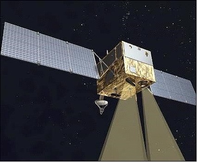
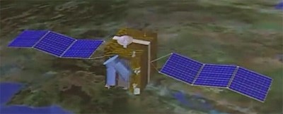
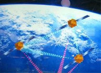
One of the main objectives of the Jianbing Ocean Surveillance program is to put an end to the near invulnerability of US aircraft carriers. An aircraft carrier and its associated naval air group are extremely well defended. They are also very mobile, which is problematic, because before you can threaten them, you must first find them. A ship sailing 20 knots can travel more than 800 kilometers a day, so geolocating a naval air group in the middle of the ocean is a difficult game of hide and seek. Jianbing 8 can only detect ships if they emit electromagnetic energy (radar, communication). Jianbing 8 is also likely able to detect early warning aircraft launched from an aircraft carrier, giving a general idea of the aircraft carrier’s location.
The Jianbing 8 constellation is formed by three satellites in three orbital planes, at 63 degrees. The satellites, possibly consisting of a primary satellite and two sub-satellites, are launched in a triplet similar to that of the US satellite constellation NOSS/Whitecloud, which is used to detect, identify, and locate radar and telecommunication emissions, particularly those from warships. This Jianbing constellation likely performs this function by locating them using a technique in which the time difference of arrival of emitted signals is measured and used to triangulate. Since 2010, nine of such triplets have been launched.
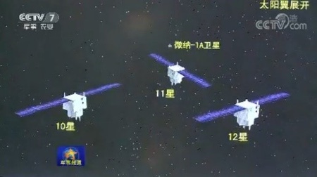
On November 6, 2021, China successfully launched a triplet of satellites, Yaogan 35 01-A, -B and -C. The satellites were placed in a circular orbit of almost 500 kilometers at 35 degrees inclination. Before the launch, China reported that the satellites would be used for "scientific experiments, land and resource logging, and other areas", but that’s probably a generic explanation to hide the satellites’ true purpose. It is believed that they may in fact be a continuation of the Jianbing 8 triplets and have a role in intelligence gathering. After the first successful launch, three more were executed in 2022.
 Jianbing 8 satellite constellation. (credit: CAST) |
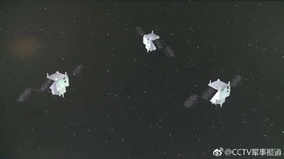 Yaogan 35 triplet of satellites. (credit: CCTV) |
Chuangxin 5 | Yaogan 30 – Ocean Surveillance
Yaogan 30 triplets are a relatively recent addition to China’s satellite detection system. The first triplet of this type was launched on September 29, 2017, under the designation Yaogan 30 01-A, -B and -C. Officially, the purpose of these satellites is to "conduct technical experiments on the electromagnetic environment," which is a euphemism for ELINT. This is consistent with the fact that ELINT satellites are often launched in triplets, such as the Jianbing 8 triplets. The advantage of a triplet is that satellites flying in tight formation, a few tens of kilometers away from each other, can triangulate and accurately locate the source of an electromagnetic signal. This is more difficult to achieve with a single satellite.
But, Yaogan 30 satellites do not fly in formation. The Yaogan 30-01 trio separated after launch and were placed 120 degrees apart. They are therefore too far apart to be able to triangulate signals, because there is not even an unobstructed line of sight between them. On the other hand, this type of layout corresponds to what is expected if three satellites are positioned in such a way that their visit frequency is maximized. Moreover, the satellites have good coverage of the Pacific Ocean, India, China, North Korea, and even Japan thanks to their low orbital inclination, the latitude that is important for China’s defense. In addition, the height of the track is remarkably low for ELINT satellites: usually these are placed relatively high, about 1,000 kilometers altitude, to increase their field of view. Imaging satellites, on the other hand, are placed low to increase their resolution while maintaining an acceptable field of view. Therefore, it is questionable whether the Yaogan 30 constellation is dedicated to ELINT: the only clues in this direction are images and official statements, which may be disinformation. The satellites could very well be small optical satellites that offer a high frequency of repetition. Up till July 2021, ten triplets of Yaogan 30 satellites have been put in space.
 Yaogan 30 triplet of satellites. (credit: CCTV) |
The Yaogan 32-01-01 and 32-01-02 are a duo of military satellites with an unknown purpose. The visualization during the launch broadcast at CCTV hints at SIGINT satellites. They were launched on October 9, 2018; a second launch took place on November 3, 2021.
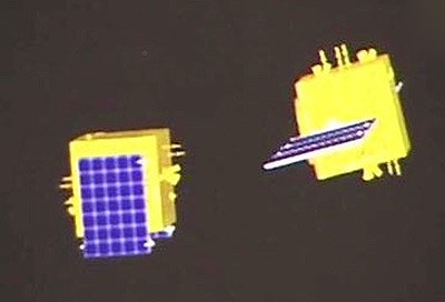 Yaogan 32 military duo satellites (2018). (credit: CCTV) |
The Yaogan 34 satellite is possibly the first of a new series of government optical remote sensing satellites, likely also used as military reconnaissance satellites. The satellite was described as an optical remote sensing satellite, mainly used in territorial research, urban planning, confirmation of land rights, road network design, crop yield estimation, disaster prevention and mitigation, and other areas. Yaogan 34, was launched in April 2021, Yaogan 34-02 followed in March 2022, in a 1100km/63.4° orbit.
The Gaofen 11 series was billed as a civilian Earth observation system but was militarily codenamed Jianbing 16.
Jianbing satellites [SCS, September 1, 2022]
| Jianbing # | Satellite Name | Year of Launch | Function/Sensors |
|---|---|---|---|
| Jianbing 1 | Fanhui Shi Weixing 0-1 – 0-9 | 1975 – 1987 | Film/Photo reconnaissance |
| Jianbing 1A | Fanhui Shi Weixing 1-1 – 1-5 | 1987 – 1993 | Film/Photo reconnaissance |
| Jianbing 1B | Fanhui Shi Weixing 2-1 – 2-3 | 1992 – 1996 | Film/Photo reconnaissance |
| Jianbing 2 | Fanhui Shi Weixing 3-1 – 3-3 | 2003 – 2005 | Film/Photo reconnaissance |
| Jianbing 3 | Ziyuan 2-1 – 2-3 | 2000 – 2004 | Electro-Optical |
| Jianbing 4 | Fanhui Shi Weixing 3-1 – 3-3 | 2004 – 2005 | Film/Photo reconnaissance |
| Jianbing 5 | Yaogan 1, 3, 10 | 2006 – 2010 | SAR |
| Jianbing 6 | Yaogan 2, 4, 7, 11, 24, 30 | 2007 – 2016 | Electro-Optical |
| Jianbing 7 | Yaogan 6, 13, 18, 23 | 2009 – 2014 | SAR |
| Jianbing 8 | Yaogan 9, 16, 17, 20, 25, 31 | 2010 – 2021 | Elint (Ocean Surveillance) |
| Jianbing 9 | Yaogan 8, 15, 19, 22, 27 | 2009 – 2015 | Electro-Optical |
| Jianbing 10 | Yaogan 5, 12, 21 | 2008 – 2014 | Electro-Optical |
| Jianbing 11 | Yaogan 14, 28 | 2012, 2015 | Electro-Optical |
| Jianbing 12 | Yaogan 26 | 2014 | Electro-Optical |
| Jianbing 16 | Gaofen 11-01, 02, 03 | 2018, 2020, 2021 | Electro-Optical |
| Jianbing X | Yaogan 29, 33, 33R | 2015, 2019, 2020 | Probably SAR |
| Jianbing ? | Yaogan 35 | 2021, 2022 (3) | Probably Elint (Ocean Surveillance) |
| Jianbing ? | Yaogan 30 (Chuangxin 5) | 2017 – 2021 | Possibly Elint (Ocean Surveillance) |
| Jianbing ? | Yaogan 32 | 2018, 2021 | Unknown |
| Jianbing ? | Yaogan 34 | 2021, 2022 | Possibly Electro-Optical |
Conclusion
Reportedly, boosted by policy support, China’s aerospace market has grown rapidly in the past seven years, with an annual growth rate of more than 20% and China is now the world’s second largest commercial satellite owner after the US. According to the UCS Satellite Database, from 2015 to 2018, China launched fewer than ten commercial remote sensing satellites annually, but the introduction of support policies helped commercial players. In 2019–2021, the annual commercial remote sensing satellites that were launched were 21, 13, and 36 respectively while the amount for 2022 is expected to be more than 50.
Note: we are using a new commenting system, which may require you to create a new account.