The secret payloads of Russia’s Glonass navigation satellitesby Bart Hendrickx
|

| The capabilities of the satellites have been gradually expanded to include a number of additional military tasks unrelated to their navigation mission. |
Glonass is an acronym standing for “Global Satellite Navigation System” and is the Russian equivalent of America’s Global Positioning System (GPS). The program was approved in December 1976 (three years after the official start of GPS) and assigned to the Scientific Production Association of Applied Mechanics (NPO PM), a manufacturer of communications, navigation, and geodetic satellites based near Krasnoyarsk in Siberia (renamed Information Satellite Systems Reshetnev or ISS Reshetnev, in 2008.) The satellites themselves have been called Uragan (“hurricane”), although that name has been rarely used in recent years. They also have indexes in the Russian military designation system beginning with 11F or 14F.
The first launch took place in October 1982, when a first-generation satellite (11F654) was placed into orbit by a Proton rocket together with two mass models. By early 1996, the constellation reached its full complement of 24 satellites, circling the Earth in three orbital planes in 19,100-kilometers orbits inclined 64.8 degrees to the Equator. In the following years, the constellation steadily declined as Russia’s economic crisis made it impossible to timely replace defunct satellites. A second generation of satellites (Glonass-M or 14F113) with more than double the design lifetime (seven years versus three) was introduced in December 2003, but it was not until early 2012 that the full 24-satellite constellation was restored.
A further modification (Glonass-K or 14F143) with an unpressurized bus and a ten-year design lifetime saw its inaugural launch in February 2011. A mix of Glonass-M and Glonass-K satellites was launched in the following years, with the final Glonass-M going up on November 28 this year. The development of a fourth generation of satellites (Glonass-K2 or 14F160) has been severely affected by Western sanctions that have hampered the supply of electronic parts to the Russian space industry. However, the Glonass-K2 series should make its debut early next year and replenish the constellation in the coming years along with newly launched Glonass-K satellites. A new constellation of satellites in highly elliptical orbits (Glonass-V) is expected to begin deployment after 2025.
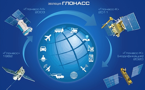 The four generations of Glonass satellites. Glonass-K2 is named “Glonass-K modification” and has been pushed back from an earlier targeted 2020 launch date. (Source: Roscosmos). |
Having started out as a purely military project, Glonass was officially declared a dual-purpose program in 1999, after which its signals also became available to civilian users. The capabilities of the satellites have been gradually expanded to include a number of additional military tasks unrelated to their navigation mission.
Lira: detecting nuclear explosions
One of Glonass’ secondary missions is to detect nuclear explosions, a task also performed by Russia’s latest generation of early warning satellites. Similarly, nuclear detection payloads have been carried by American navigation and early warning satellites. These form the space segment of the Nuclear Detonation Detection System (NDS), which is designed to provide a worldwide capability to detect, locate, and report any nuclear detonations in the Earth’s atmosphere and near space in near real-time.
Three types of sensor payloads have flown on the US satellites: the Global Burst Detection (GBD) payload on GPS/Navstar navigation satellites, using optical, X-ray, and electromagnetic pulse sensors; the Radiation Detection Capability (RADEC) payload on the geostationary Defense Support Program (DSP) early warning satellites, consisting of gamma, neutron, optical, and X-ray sensors; and the Space Atmospheric Burst Reporting System (SABRS) payload for two classified host satellites in geostationary orbit and the STPSat 6 satellite, using neutron, gamma-ray, and space environmental sensors. The first GPS satellite to fly a nuclear detection payload was launched in 1980. According to unclassified US Air Force procurement documents, NDS supports nuclear detection requirements across five mission areas: tactical warning and attack assessment, nuclear force management, nuclear treaty monitoring, space control, and a classified mission.
| Lira seems to have been conceived in the late 1980s in response to the introduction of nuclear detection payloads on GPS satellites earlier that decade. |
While the existence of the NDS space segment is not classified, it has not been widely advertised either. The same applies to the Russian system, but information on it is much more elusive and mainly found in academic papers and online tender and court documentation. An overall designation for the Russian system seen in a handful of sources is KS OZYaV (“Space Segment of the Nuclear Detection System”). The Glonass-based system is called Lira (the Russian spelling for the constellation Lyra) and the system using the early warning satellites is probably named Altair (the brightest star in the constellation Aquila). Both consist of space-based sensors and a ground segment to operate the sensors and receive and process information from them. OZYaV also includes ground-based nuclear detection systems spread across the Russian Federation.
Lira seems to have been conceived in the late 1980s in response to the introduction of nuclear detection payloads on GPS satellites earlier that decade. Before flying the GPS and DSP-based sensors, the United States had operated dedicated nuclear detection satellites named Vela, but there had been no equivalent system in the Soviet Union. The Lira project began in earnest on January 15, 1990, when NPO PM awarded a contract for the system to the Scientific Center of Optical and Physical Research (NTsOFI). The nuclear detection payload was originally called Zarya (“dawn”), but was later renamed BAL, which stands for “Lira On-Board Equipment”. Due to financial issues, NTsOFI withdrew from the project in the mid-1990s and was replaced as Lira’s prime contractor in May 1997 by the Scientific Research Institute of Precision Instrument Building (NII PP), renamed the Scientific and Industrial Corporation “Precision Instrument Systems” (NPK SPP) in 2007.[1] The work has been led for many years by Yuri P. Vagin, who heads the company’s Department 03. Judging from several jointly published articles on the subject, it has been done in close co-ordination with a Ministry of Defense institute known as 12 TsNII, which does research on the effects of nuclear explosions.[2]
The first nuclear detection payload was launched aboard Kosmos-2382 on December 1, 2001. This was a modified first-generation Glonass satellite (designated 14F17) with a longer design lifetime than its predecessors (five instead of three years). Its development had been approved in 1989, but took much longer than expected due to the collapse of the Soviet Union. It rode into orbit together with two standard first-generation satellites and is believed to have been the only of its type ever flown, although hardware for at least two more was built. It is not clear if it carried the original BAL payload developed by NTsOFI or a modified or new payload produced by NPK SPP.[3]
Nuclear detection sensors became a standard payload for Glonass satellites with the introduction of the Glonass-M series in December 2003. The Glonass-M payload is called BAL-M and modified versions called BAL-K and BAL-K2 were designed for the Glonass-K and K2 satellites.[4] A contract for BAL-K2 was signed between ISS Reshetnev and NPK SPP on February 24, 2011. A newsletter published by NPK SPP in 2016 revealed that the Glonass-M based Lira system became functional only in 2010, which suggests that it had operated in an experimental mode until that time.[5]
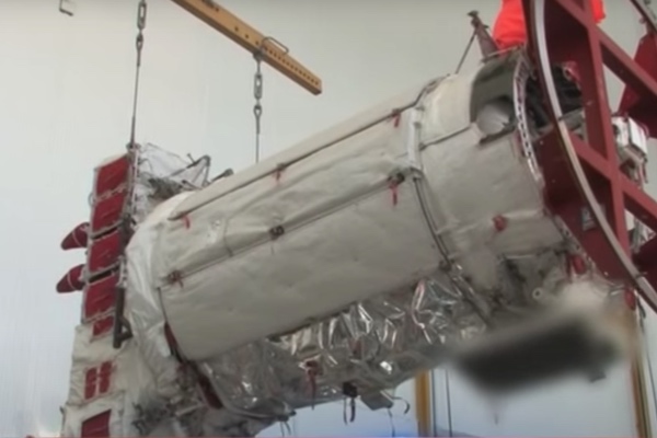
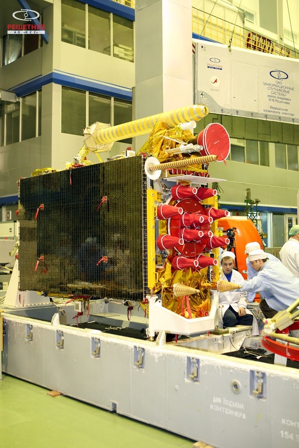
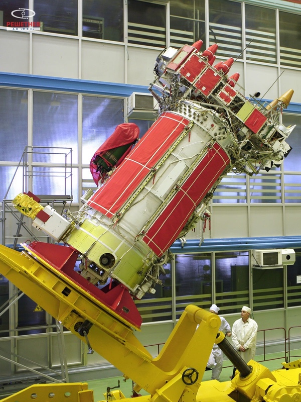 A Glonass-M satellite undergoing final assembly. (Source: ISS Reshetnev) |
The BAL-M payload has been described in some detail in various articles.[6] It can register ionizing radiation (mainly in the form of gamma rays), optical light, and electromagnetic pulse radiation. The optical equipment looks for nuclear detonations in the visible and near-infrared part of the spectrum and determines the time of arrival of the signal, its amplitude and length, using special techniques to filter out the explosion from the Earth’s much stronger background radiation. The ionizing radiation is measured with the help of three gamma-ray scintillators that are installed on different parts of the satellite to minimize the risk of a false detection. No further information is available on the electromagnetic pulse sensor. The detection instruments are regularly calibrated, for instance by laser sensing and observations of lightning. Data on ionizing radiation is compared with that received by instruments on other satellites such as particle detectors aboard America’s GOES weather satellites.
The coordinates of the event are determined using the so-called differential ranging method, which relies on the fact that the satellites’ position in space is known with great accuracy and their on-board atomic clocks are synchronized to a common time scale. By comparing the moment that an explosion is detected by different satellites, it becomes possible to determine where it took place.
The BAL-M payload has its own computer system, which is connected to the satellite’s main computer. It receives commands for BAL via the main computer and routes power to the payload’s instruments. It also performs preliminary processing of the data and relays the information back to the ground via the main computer.
The BAL-M payload has also been used to observe gamma-ray bursts, cosmic and galactic radiation, interactions between the Sun and the ionosphere, lightning, volcanic activity, and what are called “technogenic catastrophes.” Results of these observations have been published in various scientific papers.
The exact location of the BAL-M instruments on Glonass-M is not known. It is worth noting, however, that an object attached to the lower part of the satellite has been intentionally blurred in some video footage of Glonass-M, indicating that it is considered a secret payload.
 Blurred payload attached to Glonass-M nr. 53, launched as Kosmos-2516 in May 2016. Source |
 The same object (on the lower right part of the satellite) has also been blurred in this image of a Glonass-M satellite launched in September 2010. Source |
It does appear in a handful of videos as a rectangularly shaped black object, but it is impossible to tell whether it belongs to the BAL-M payload or not. The fact that it is seen in images of different Glonass-M satellites suggests that it is a standard payload.
 The black payload is seen in the lower left of this image of Glonass-M nr. 60 undergoing ground testing in 2015. The satellite was launched as Kosmos-2545 in March 2020. Source |
Little has been revealed about the upgraded payloads for Glonass-K and K2. They have a broader suite of instruments, including a detector of “ultra-shortwave electromagnetic radiation” (most likely electromagnetic pulse radiation) and a highly sensitive optical instrument that can also determine the coordinates of thunderstorms and observe meteorites entering the Earth’s atmosphere. Procurement documentation for the BAL-K and BAL-K2 payloads mentions instruments named BROI, BRII, BRGA, and UFVI, which probably cover different parts of the electromagnetic spectrum (optical, infrared, gamma, and ultraviolet). Part of one of the instruments are photodiodes sensitive to visible and near-ultraviolet light (A-281A and A-281B) produced by NPP Pulsar. Another instrument named SVAN is described as a spectral analyzer.[7]
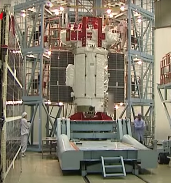
 A Glonass-K satellite undergoing final assembly at ISS Reshetnev. (Source: ISS Reshetnev) |
There is scattered information on Lira’s ground segment, which was modernized under the name Lira-M under a contract awarded by the Ministry of Defense to NPK SPP on November 8, 2011. Lira-M in turn was part of a broader effort to modernize the Glonass ground segment approved under the name Kapella around 2008–2009. The plan was for Lira-M to have its own control center, which would interact with the main control center for Glonass (TsUS-UM), situated in Krasnoznamensk some 50 kilometers southwest of Moscow. Its functions seem to be limited to sending commands to the BAL payloads and receiving telemetry from them, with TsUS-UM acting as an interface between the two.[8]
| Russia may now possess a space-based nuclear detection capability that may even far exceed the requirements laid out for it many years ago. |
The data are received and processed by ground terminals called NAPOI (“Ground-Based Equipment for Reception and Processing of Information”). There are both stationary versions (NAPOI-S) and mobile versions, the latter coming in two types (NAPOI-M1 and M2). By the end of 2016 up to 40 vehicles were expected to be outfitted with NAPOI-M2 units. Other abbreviations seen in tender documentation are PAP-ST and PAP-M (for stationary and mobile user equipment), which seem to feed Glonass navigation data to NAPOI’s computer system. Also planned were airborne receivers (VAPOI), but it is not known if these have been deployed. By 2016 NAPOI systems were operational in Russia’s Central, Western, Eastern and Southern Military Districts.[9]
Various procurement and court documents make it possible to link one of the NAPOI-S terminals to what appears to be a command post for Russia’s Strategic Rocket Forces designated V209-VRP. This was designed by a company called Strategic Command Posts (SPU-TsKB) under a contract awarded by the Ministry of Defense in 2013 as part of a project called Grot-M. This is a clear sign that Lira is not only intended for nuclear treaty monitoring, but also to support the launch of a retaliatory strike in case Russia comes under nuclear attack.[10] Another potential task of Lira mentioned in one article is to confirm the detonation of Russian nuclear weapons on foreign territory.[11]
Lira can observe nuclear blasts with yields ranging from one kiloton to five megatons all the way from the ground to an altitude of 20,000 kilometers. It can determine the coordinates of a nuclear explosion with an accuracy of 300 meters, but it would appear that this can only be achieved if at least four Glonass satellites see the event simultaneously. End users can be informed of an explosion with a delay of just 30 seconds, assuming that the Glonass satellites observing the event are within range of NAPOI terminals.[12]
One article published in 2013 said that Glonass satellites not within range of those terminals could theoretically relay information to other Glonass satellites via laser or radio communication links in the 20-40 GHz range, adding that this capability was not likely to become available in the near future. However, the Glonass-M satellites do carry an intersatellite radio communication system (called BAMI) and, according to a Glonass history published in 2012, one of its purposes is to relay information on nuclear explosions. Some Glonass-M satellites have also tested intersatellite laser communication systems, which are expected to become a standard feature of Glonass-K2 satellites.
The article also pointed out that Lira should consist of a constellation of 18 satellites to provide reliable coverage of nuclear detonations, with 12 being the bare minimum. It noted Lira’s vulnerability to foreign anti-satellite attacks, saying that the best way of countering this threat is to have a significant number of backup satellites on the ground and in space to replenish the constellation at short notice if necessary. On-board ASAT protection systems would be prohibitively costly and heavy.[13]
The article called for a closer integration of Lira with the country’s missile early warning network, which could provide Lira with information on the predicted coordinates of a nuclear blast, the weapon’s expected yield and the number of missiles launched. Nuclear detection instruments are now also flown on Russia’s newest generation of missile early warning satellites, although it is not clear if their early warning telescopes can feed data directly to that payload. The satellites belong to the so-called Integrated Space System (EKS) or Kupol, which is supposed to consist of satellites in highly elliptical Molniya orbits (named Tundra) and geostationary orbits. So far only Tundra satellites are in orbit, with six having been launched since 2015. A nuclear detection payload called Balka, produced by NPK SPP, is known to have been carried by the first satellite and is likely to be on the subsequent ones as well.
Very little has been revealed about the EKS payload. According to the earlier mentioned 2013 article, it was supposed to include a gamma-ray detector and two optical detectors operating in slightly different wavelengths (0.35–0.45 and 1.5–2 microns, the latter being in the near-infrared). It would use more efficient communication channels and be more advanced than the Glonass-based system, allowing a single satellite to detect a nuclear blast with a high degree of certainty. Another article also refers to an instrument operating in the near-ultraviolet.[14] One of the instruments uses A-181A and A-181B photodetectors, suggesting at least some commonality with Glonass-K2’s BAL-K2 payload.[15]
Assuming that all the Glonass and Tundra satellites currently operational (around 30 satellites in total) have nuclear detection payloads, Russia now possesses a space-based nuclear detection capability that may even far exceed the requirements laid out for it many years ago.
KSPS-MO: rescuing military personnel
A secondary payload that will be introduced on the Glonass-K2 satellites is designed to pick up and relay distress signals from military personnel in emergency situations. It is the military equivalent of the Kospas/Sarsat system, an international satellite-aided search and rescue system that was conceived and initiated by Canada, France, the United States and the Soviet Union in 1979 (“Sarsat” stands for “Search and Rescue Satellite System” and Kospas is the corresponding Russian acronym). It detects and locates emergency beacons activated by ships, aircraft, and people engaged in recreational activities in remote areas and relays these distress alerts to search-and-rescue authorities. Between September 1982 and December 2021, the system assisted the rescue of more than 54,000 people.
Kospas/Sarsat transponders have been carried by satellites in low, medium, and geostationary orbits (LEO, MEO, GEO). The LEO satellites (operating in polar orbits) determine the position of emergency beacons by using the Doppler effect as they pass over a beacon transmitting at a fixed frequency. Their main drawback is that they can only see a small part of the Earth’s surface at any given time, meaning that there can be significant delays in both receiving and relaying the distress signal. GEO satellites have the advantage of providing permanent real-time coverage of large areas from their fixed positions high above the Earth, but they are limited to relaying the distress signals because the absence of relative motion to the beacons does not make it possible to locate them precisely (unless the beacons are equipped with GPS receivers). The MEO satellites blend the advantages of the LEO and GEO systems, while avoiding their disadvantages. They have relatively large footprints and sufficient motion relative to the beacons to use the Doppler positioning technique.
The currently operating Russian satellites equipped with Kospas/Sarsat transponders are the Meteor-M 2-2 weather satellite in LEO, the Arktika-M remote sensing satellite in a highly elliptical Molniya orbit, several Elektro-L weather satellites and Luch-5 data relay satellites in GEO, and five Glonass-K navigation satellites in MEO. Kospas/Sarsat transponders are also flown on navigation satellites operated by other countries (the US GPS/Navstar satellites, Europe’s Galileo satellites and China’s Beidou satellites).
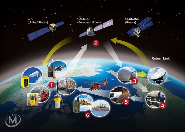 The international Medium Earth Orbit Search and Rescue System (MEOSAR). The signal from a distress beacon (1) is intercepted by a MEOSAR transponder installed on a navigation satellite (2) and transmitted to a ground station (3); the signal is then forwarded to a mission control center (4) and then to a rescue-response center (5) which coordinates the rescue (6). Source |
An upgraded Kospas/Sarsat transponder named BRKS-K2 (“On-Board Rescue Radio Complex”), developed by Russian Space Systems, will be flown on the next-generation Glonass-K2 satellites. In addition to that, they will have a search-and-rescue payload intended exclusively for military users. Its existence can only be determined from a handful of online documents and technical articles.[16]
| A feature of both the civilian and military Glonass-K2 search and rescue systems is that they can send a return message to the emergency victims, notifying them that their distress signal has been received and help is on the way. |
The payload is known as BRKPS-MO (On-Board Search and Rescue Radio Complex of the Ministry of Defense) and the overall name for the space and ground segment is KSPS-MO (Space Search and Rescue System of the Ministry of Defense), also designated 14Ts781M. The project officially started on December 27, 2012 as part of a government contract awarded by the Ministry of Defense to NPK SPP under the name Banderol (“parcel”), which also included other Glonass-related work. NPK SPP assigned KSPS-MO to a subcontractor named MKB Kompas, which had apparently already worked on the system under a direct contract with the Ministry of Defense before it was incorporated into Banderol.[17] MKB Kompas is responsible for both the space and ground segment of KSPS-MO.
As can be learned from technical specifications for KSPS-MO published in 2012, the system can be used by Navy ships, Air Force planes, and ground forces. They are outfitted with beacons transmitting distress signals in the 400–410 MHz frequency range at a rate of at least 250 bits per second. The exact frequency is most likely 406 MHz, also used by the Kospas/Sarsat beacons, but indications are that the beacons are designed uniquely for KSPS-MO.
The distress signal contains the user’s unique identification number and provides clues on the type of emergency and the moment that it occurred. This can be determined from whether the beacon was activated manually or triggered automatically and when this happened. Also included in the signal is data on the location of the user, suggesting that the beacon is linked to a satellite navigation receiver. The aim was for KSPS-MO to be capable of determining the location of an emergency beacon with an accuracy of no worse than 30 meters. Special measures were to be taken to ensure that information on the user’s coordinates would be protected (presumably by encrypting the signal). Although not stated specifically, KSPS-MO is most probably not compatible with Kospas/Sarsat transponders on non-Russian satellites, meaning that users would have to wait for a Glonass-K2 satellite to appear over the horizon for the signal to be picked up.
After the distress signal is received by Glonass-K2, it is relayed to military authorities via the satellite’s L2KSI navigation signal. If there is no ground station in line of sight, the signal can be transmitted to other Glonass satellites that are within range of ground stations. KSPS-MO appears to have its own ground segment, consisting of what are called a “monitoring center” and “regional information reception and processing centers” that are on standby 24 hours per day to receive distress signals from military users.
A feature of both the civilian and military Glonass-K2 search and rescue systems is that they can send a return message to the emergency victims, notifying them that their distress signal has been received and help is on the way. This is a capability offered so far only by Europe’s Galileo satellites, where it is known as the Return Link Service. The Galileo satellites transmit the distress signal to a facility in Toulouse, France, from where an automatic message is sent back to the users via the satellites confirming that their position has been detected and the information has been passed to the relevant government authorities.
In the KSPS-MO system, the objective was for users to receive the return message within five minutes of having sent out the distress signal. If necessary, it can be relayed via intersatellite links to a Glonass satellite that is flying over the region where the emergency has occurred. The message is sent to the ground via the same L2KSI navigation signal in the 400–410 MHz range and once it arrives, the emergency beacon is switched off. While Glonass-K2’s civilian and military search-and-rescue payloads operate independently, published schemes show that they do share a common antenna and amplifier system to forward the return signal to the user.[18]
Back in 2012, the hope was to begin tests of the KSPS-MO system in the 2018–2019 timeframe, but those plans clearly did not materialize. This is probably the result of delays in the development of the Glonass-K2 satellites, not KSPS-MO itself. It is known from procurement documents that MKB Kompas ordered thermal vacuum tests of five BRKPS-MO payloads (each weighing around 10 kilograms) in 2019, indicating that their production had been completed at the time.[19] Assuming the ground segment is also ready by now, there is every reason to believe that KSPS-MO will enter service with the launch of the first two Glonass-K2 satellites next year.
Ruveta: collecting targeting data for the Russian Navy
The most secretive Glonass payload is named Ruveta (the Russian word for “oilfish”, a species of snake mackerel). The name first appeared in a Glonass history published in 2012, which did not disclose anything about its purpose.[20] The next reference to Ruveta came in ISS Reshetnev’s annual report for 2016, where it was said to have been the subject of a court case between the company and the Ministry of Defense. All that could be learned from documentation on this court case was that a contract related to Ruveta was signed on April 3, 2008, presumably between the two parties involved in the case.[21]
Nothing more was heard of Ruveta until the US New Lines magazine published a story in July 2021 that was based on a joint investigation with the Estonian Delfi.ee news portal and the Czech Respekt magazine. The article quoted an anonymous intelligence source from a European NATO member state as saying that Ruveta is a signals intelligence system that will furnish target location data on NATO surface vessels to Russian naval forces to support engagement with long-range anti-ship missiles such as the 3M-54 Kalibr. The source added that this information was supported by documents that the intelligence agency possesses and assesses to be “one hundred percent reliable.”[22]
A search of Russian online sources has turned up some additional details on Ruveta that back up the information provided in the New Lines story. Ruveta is the subject of a recent court case involving Morinformsistema-Agat (also known as Morinsis-Agat), a company that produces instruments and equipment for warships, including control systems needed to fire sea-based ballistic and cruise missiles. According to the related documentation, Morinformsistema placed an order on October 31, 2019, for the delivery of one or several instruments known as UKPRSI-K-01, which are part of a project called Tsiklop-Ruveta. The contract was awarded to the Scientific Research Institute of Precision Instruments (NII TP), a company belonging to the Russian Space Systems (RKS) holding and described in the documents as Ruveta’s prime contractor.[23]
Another recent court case between Morinformsistema and NII TP revolves around systems called UKPOS-K and UKPOS-N developed under two contracts concluded between the companies on July 24, 2009. Paperwork related to this case also refers to a contract between NII TP and ISS Reshetnev, meaning this work is almost certainly related to Ruveta as well.[24]
| Although the information is fragmentary, Tsiklop would seem to be a reconnaissance system that collects targeting information for Russian Navy vessels from a variety of assets. One of those would then be Ruveta, which presumably includes a signals intelligence payload installed on Glonass satellites. |
So far it is unclear what UKPOS means, although the “K” and “N” may well stand for the Russian words for “space-based” and “ground-based”. The abbreviation UKPRSI, on the other hand, is deciphered in tender documentation as “Unified Complex for the Reception and Registration of Special Information”. This documentation also reveals that Morinformsistema placed an order with NII TP in October 2015 to provide “experimental versions” of UKPRS as well as data processing software for Tsiklop-Ruveta.[25]
The order was linked to Project 20385, which is the code name for a class of corvettes known as Gremyashchiy (“thunderous”). This is an advanced variant of the Steregushchiy multi-purpose corvettes, which have been in service with the Russian Navy since 2007. They are equipped with eight launchers for Kalibr, Oniks, or Tsirkon anti-ship cruise missiles. Project 20385 got underway in 2006, with the first ship (named Gremyashchiy) being commissioned in the Pacific in 2020. A second one (Provornyy), also to be deployed in the Pacific, suffered severe fire damage in December 2021 and may not enter service until 2024. Six more are expected to be commissioned by both the Pacific and Northern Fleets in 2027–2028.
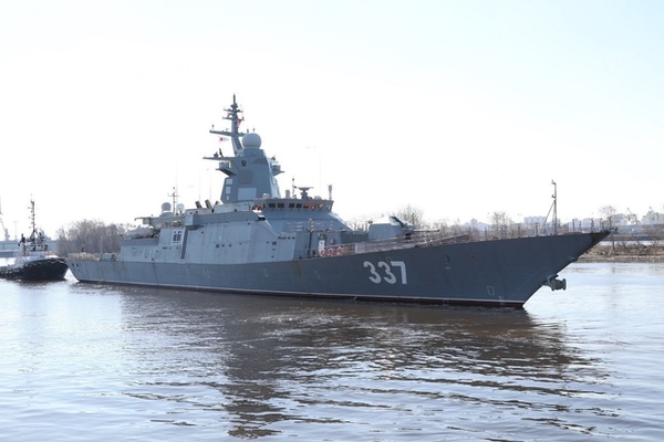 Gremyashchiy, the first of a new class of corvettes for the Russian Navy. Source |
Other tender documentation that appeared online in August 2017 makes it clear that the UKPRSI system was also to be delivered for submarines developed under Project 949AM.[26] These are upgraded versions of the Project 949A/Antei nuclear-powered submarines and are reportedly capable of carrying up to 72 Oniks, Kalibr, and Tsirkon cruise missiles, making them the most heavily armed submarines of the Russian Navy. There are a total of seven Project 949A submarines, one of which (the Irkutsk) is currently being converted into a 949AM type and expected to rejoin the Pacific fleet in late 2023. Another one (the Chelyabinsk) should follow several years later.
Judging from the available online documentation, Ruveta is part of a larger project named Tsiklop (the Russian word for “Cyclops”, a one-eyed giant in Greek mythology.) This is run by Morinformsistema-Agat and back in 2012 its chief designer was Yevgeniy S. Novikov, who headed the company from 2003 until 2011. In procurement documents, Tsiklop is described as a “georeconnaissance system” for the Russian Navy. One element of Tsiklop mentioned in that documentation is called “Product 83T269”, a set of computer systems that maintains “a database of basic and current information” and “provides coordinate information to users”. [27]
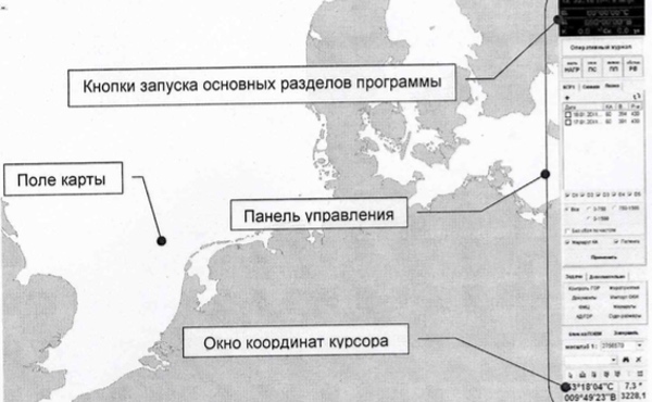 Tender documentation for Tsiklop’s “Product 83T269” includes this view of a computer screen showing the coordinates of a target off the coast of the Netherlands. Source |
Although the information is fragmentary, Tsiklop would seem to be a reconnaissance system that collects targeting information for Russian Navy vessels from a variety of assets. One of those would then be Ruveta, which presumably includes a signals intelligence payload installed on Glonass satellites and a ground-based system (UKPRSI) to receive that information. NII TP seems to provide both the space-based instruments (under contracts with ISS Reshetnev) and the ground-based equipment (under contracts with Morinformsistema). The available documentation makes it possible to identify only two types of vessels equipped with the UKPRSI system (the Gremyashchiy class frigates and the Project 949AM submarines), but there could well be many more.
If Ruveta is indeed a signals intelligence (SIGINT) system to provide targeting data to Russian Navy vessels, it would essentially perform the same role as the Liana satellite constellation. This consists of two types of satellites (Lotos-S and Pion-NKS) in 900-kilometer orbits inclined 67 degrees to the Equator. Both Lotos-S and Pion-NKS use SIGINT antennas to locate naval targets and Pion-NKS, in addition to those, has a radar system to perform the same task. Currently, five satellites are believed to be operational, four of the Lotos-S type and one Pion-NKS. The two most recently launched Lotos-S satellites are the first of a batch of four ordered in 2017 and another order for an unspecified amount of satellites was announced last summer. Pion-NKS is not likely to be joined by a sister satellite anytime soon, since it was recently announced that no final decision has been made yet on the construction of a second satellite. Liana was eventually expected to be replaced by a new SIGINT system called Akvarel, but nothing of it has been heard in recent years.[28]
Ruveta is probably seen as being complementary to Liana. This is demonstrated by the fact that the Project 949AM submarines will be equipped with receivers for both Liana and Ruveta. One advantage of Ruveta is that the Glonass satellites are in much higher orbits (nearly 20,000 kilometers above the Earth), giving them a much wider field of view than the Liana constellation. The combination of Liana satellites and Ruveta-equipped Glonass satellites could give Russia the capability to track the movements of enemy ships on a virtually continuous basis. Sea-launched missiles such as the Kalibr have also been used against stationary land-based targets during Russia’s military operations in both Syria and Ukraine, but the main purpose of the space-based SIGINT systems seems to be to provide real-time data on the position of moving sea-based targets.
According to the earlier mentioned 2012 Glonass history, Ruveta was planned for launch on what was then called Glonass-KM. This later evolved into Glonass-K2, which is the platform that will carry the Ruveta payload according to the 2021 New Lines article. Glonass-K2 is significantly heavier than Glonass-K (1,645 versus 935 kilograms), has double its height (six versus three meters) and a significantly higher power supply (4.37 versus 1.6 kilowatts), making it easier to accommodate secondary payloads. ISS Reshetnev officials have regularly called it a multifunctional satellite that will not be used only for navigation. Assuming Ruveta is a SIGINT system, it should feature one or several antennas protruding from the exterior of the satellite. These are not seen in published illustrations of the satellite, but could have been deliberately left away. No pictures of Glonass-K2 satellites undergoing assembly have been released so far.
The long-delayed flight of the first Glonass-K2 (serial number 13L) is now set for the first quarter of next year, with a second satellite (nr. 14L) expected to follow later in 2023. These two are considered experimental forerunners of the following batch of Glonass-K2 satellites, which, in accordance with Russia’s import substitution policy, will carry far less Western electronic components (just 12 percent.) They will also differ externally from their predecessors, having a box-shaped bus. Although they are still called Glonass-K2, they have a different military index (14F170 versus 14F160 for the first two satellites), reflecting the changes in design. A subsequent batch is supposed to do away with Western-built electronic components altogether. Around thirty of the upgraded Glonass-K2 satellites (beginning with serial nr. 24L) are expected to be launched beginning in 2024, some flying solo on Soyuz-2 rockets, others in pairs on Angara-A5 rockets.
Considering the fact that Ruveta has been under development since at least 2008, it should be ready to fly by now. Whether it will see its inaugural mission on the 14F160 satellites or the significantly different 14170 series remains to be seen. Much also hinges on the status of the ground segment, in particular the number of Navy vessels equipped with Ruveta receivers. Whenever it flies, Ruveta is sure to remain a closely guarded secret. While nuclear detection payloads and search and rescue transponders are also flown on US navigation satellites, the use of such satellites for signals intelligence is a first that Russia will not want to share with the rest of the world.
References
(all sources in Russian unless otherwise noted)
- Court documents published in February 2001 and March 2001 ; Papers published by NTsOFI in 1996 (1 and 2).
- Papers published by NPK SPP and 12 TsNII in 2010 and 2011 (only abstracts available).
- History of Glonass published in “Vestnik GLONASS” magazine, December 2012. The original article is no longer online, but it has been re-published here.
- See, for instance, this NPK SPP paper published in 2013 (only abstract available).
- NPK SPP newsletter published in December 2016, p. 2
- Descriptions of BAL-M are given in NPK SPP papers published in 2013 and 2020 (in English, p. 264-265).
- Tender documentation published in 2018.
- Tender documentation published in 2015 (1 and 2).
- NPK SPP newsletter published in December 2016, p. 2 ; A.I. Yefimako, Yu.A. Mitasov, “Increasing the reliability of detecting nuclear explosions with the space segment of the Lira nuclear detection system” (in Russian), paper presented by two researchers of the Strategic Rocket Forces Academy at a conference in 2013 (no longer available online).
- Tender documentation published in 2016 ; Court documentation published in 2019-2020 and 2021-2022. Code names associated with Grot-M are Yashma, Tsitrin and Magniy. Grot-M is also the name of an unrelated Glonass portable receiver.
- A.I. Yefimako, Yu.A. Mitasov, op. cit.
- Article published in 2020.
- A.I. Yefimako, Yu.A. Mitasov, op. cit.
- NPK SPP article published in 2020 (p. 63-65).
- More on the EKS satellites and their nuclear detection payload in: B. Hendrickx, EKS: Russia’s space-based missile early warning system, The Space Review, February 8, 2021.
- Most of the information on KSPS-MO comes from technical specifications for the Banderol project published in 2012 and a paper presented during a conference in 2020.
- Court documentation published in 2021-2022.
- Articles published by Russian Space Systems in 2015 (p. 58-64) and 2017.
- Tender documentation published in 2019.
- History of Glonass published in “Vestnik GLONASS”, December 2012. The excerpt on Ruveta was removed in this re-publication of the article, but can still be found in a posting on a Russian spaceflight forum in 2012.
- ISS Reshetnev’s annual report for 2016 ; Court document published in 2016.
- H. Roonemaa, M. Weiss, Western Intelligence Fears New Russian Sat-Nav’s Espionage Capabilities, New Lines Magazine, July 12, 2021.
- Court documentation published in 2022.
- Court documentation published in 2022.
- Tender documentation published in 2016.
- Tender documentation published in 2017.
- Tender documentation published in 2013.
- More on Liana in: B. Hendrickx, The status of Russia’s signals intelligence satellites, The Space Review, April 5, 2021.
Note: we are using a new commenting system, which may require you to create a new account.