Carriers from space (part 1)by Dwayne A. Day
|
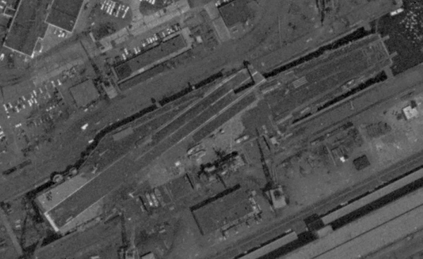
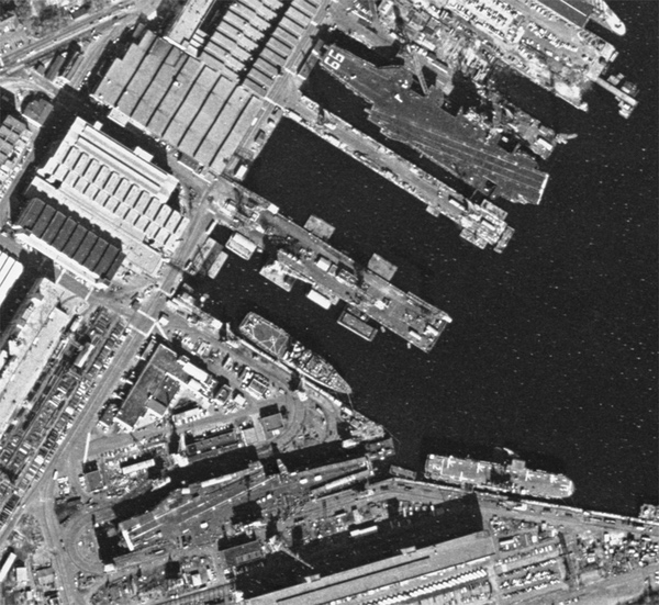
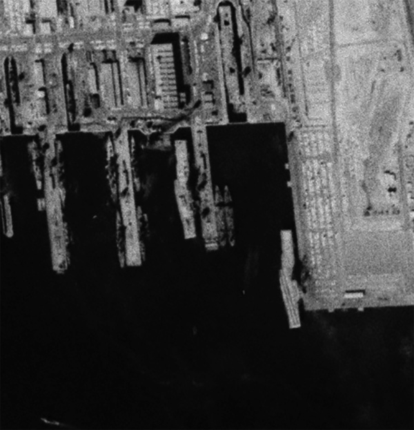 Long Beach was another major naval facility on the US West Coast during the Cold War. This February 1964 photo shows two anti-submarine carriers at their piers and the helicopter carrier USS Princeton in drydock. (credit: NRO via Harry Stranger) |
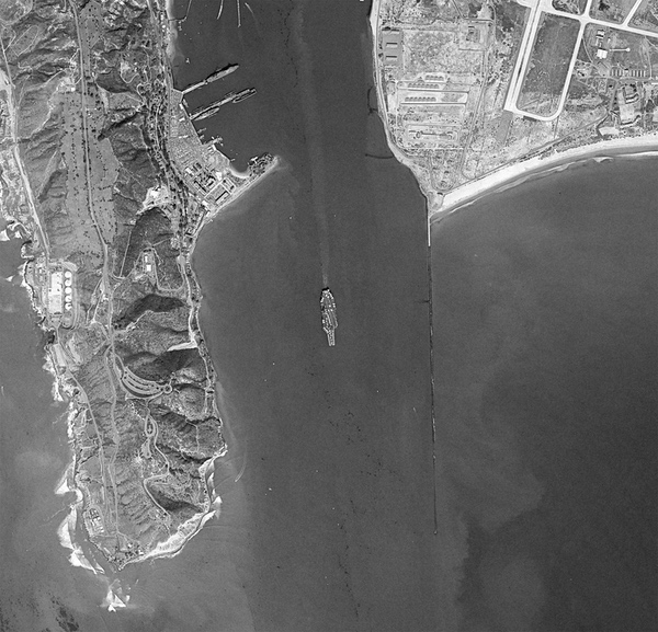
In February 1964, a CORONA satellite photographed the Navy base at Long Beach, south of Los Angeles. During the Cold War the US Navy had large bases on both coasts, many supporting dozens of ships. On the West Coast, aircraft carriers were based in San Diego, Long Beach, San Francisco, and Alameda, California, and underwent maintenance at Bremerton, Washington. The CORONA satellite photographed some of this impressive naval power during its pass over Long Beach: two angled-deck carriers were visible dockside, along with a straight-deck helicopter carrier in dry-dock. At the time, approximately half a dozen Essex-class carriers were based at Long Beach, including attack, anti-submarine, and straight-deck helicopter carriers. The dry-docked ship was probably USS Princeton, an Essex-class carrier converted to handle helicopters and Marines. A sister ship based at Long Beach, USS Valley Forge, had recently put to sea. Valley Forge later served as the filming location for the 1972 science fiction movie Silent Running shortly before the ship was scrapped.
The CORONA satellite’s resolution was too low to show the identification numbers on the flight decks of the other two ships at their piers. However, a review of USS Yorktown’s logbook entry for the day when the satellite took the photograph reveals that Yorktown was in port, as was her sister ship USS Bennington, both ships tasked with hunting submarines in the Pacific Ocean. Yorktown later served as the Apollo 8 mission recovery ship.
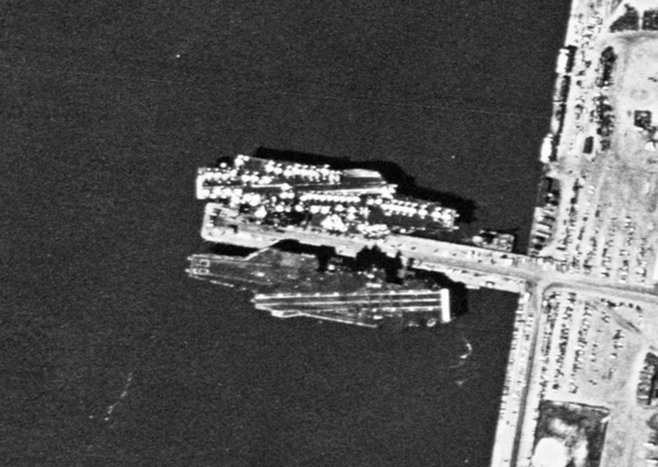
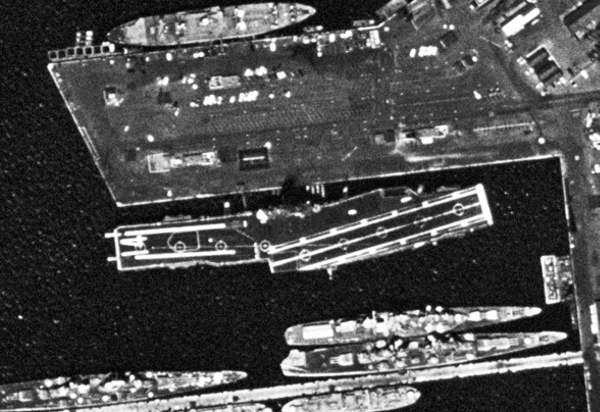
 A US Navy aircraft carrier near Hong Kong, which served as a major resupply port during the Cold War. (credit: NRO via Harry Stranger) |
In November 1964 and August 1972, American reconnaissance satellites photographed American aircraft carriers moored in Hong Kong, then a major overseas resupply port.
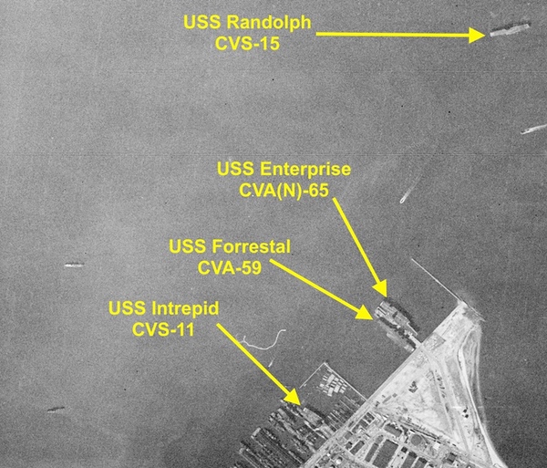
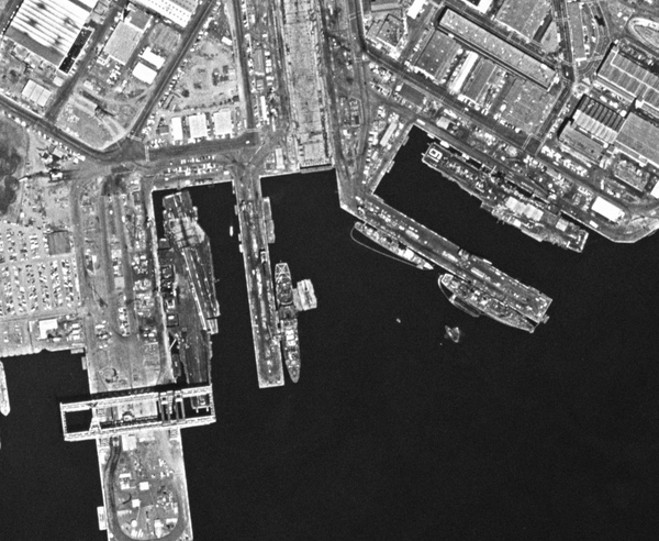
 USS Randolph, which appeared in the 1963 CORONA image, was photographed at higher resolution by a GAMBIT satellite in 1965. The ship's registry number is clearly visible on the flight deck. Randolph was used as a recovery ship for several Mercury missions. (credit: NRO via Harry Stranger) |
In May 1965, a GAMBIT mission photographed two of the same carriers spotted in Norfolk by the CORONA satellite in December 1963. The anti-submarine carrier USS Randolph was at a dock—in the early 1960s, Randolph had participated in Mercury spacecraft recoveries. The GAMBIT also photographed USS Forrestal in dry-dock, undergoing maintenance. In the higher resolution photo taken by the GAMBIT satellite, both carriers’ identification numbers were easily visible on their flight decks.
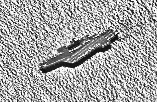
 The supercarrier USS Forrestal was also photographed at Norfolk in May 1965. The ship was in dry-dock as the time. (credit: NRO via Harry Stranger) |
Most of the time CORONA and GAMBIT satellites photographed targets in the Soviet Union and other “denied territories.” But the reasons to photograph American military facilities included training photo-interpreters about what they were looking at, and using the photos to show military officers who would recognize their own facilities and equipment and therefore better understand reconnaissance satellite capabilities.
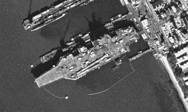
 USS Enterprise is seen here at Norfolk in 1973. The other ship may be USS America. (credit: NRO via Harry Stranger) |
In July 1971, the first mission of the new HEXAGON reconnaissance satellite photographed US Navy facilities at Hunters Point Naval Shipyard, San Francisco, and Alameda, just across the bay. No carriers were moored at Naval Air Station Alameda on that day, but at Hunters Point both USS Ranger and the older USS Hancock were present. Hancock was one of the last World War II Essex-class carriers to be withdrawn from service, finally decommissioning in January 1976. The ship was occasionally moored across the bay at Alameda, which was the location where some of the starship Enterprise’s crew went to locate “nuclear wessels,” and collect “photons” from the nuclear-powered aircraft carrier USS Enterprise in the 1986 movie Star Trek IV.
 San Francisco was another major naval facility during the Cold War. Here the USS Ranger and the smaller USS Hancock are seen at dockside. (credit: NRO via Harry Stranger) |
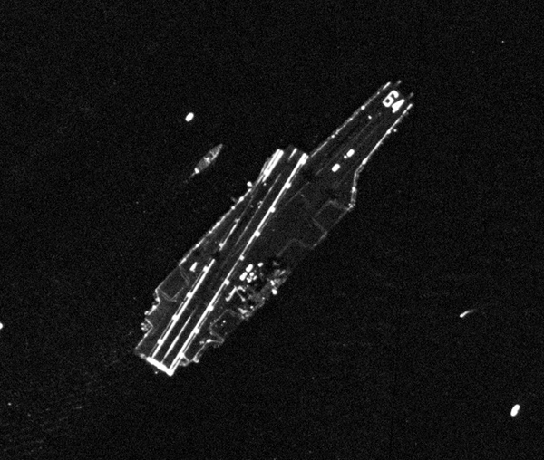
 The USS Dwight D. Eisenhower, the US Navy's third nuclear-powered aircraft carrier, was photographed by a reconnaissance satellite in November 1976 while still under construction. Eisenhower is still in service and recently saw substantial action in the Red Sea. (credit: NRO via Harry Stranger) |
In April 1973 and again in November 1976, HEXAGON satellites photographed Norfolk, both the naval base and the nearby shipyard where construction and major maintenance was conducted. By this time almost all of the World War II-era aircraft carriers had been retired and replaced by much larger, multi-role aircraft carriers. The HEXAGON images showed USS America (CV-66), although the other ships are harder to identify and their deck logs are not available in the National Archives. One of the ships in the 1976 images is possibly USS John F. Kennedy, another is possibly USS Nimitz, which had recently entered service as the Navy’s second nuclear-powered aircraft carrier. Another ship that appears to be undergoing final construction is probably USS Dwight D. Eisenhower, which entered service in 1977.
 USS America and USS Independence were photographed at Norfolk Naval Shipyard in 1976 undergoing maintenance. (credit: NRO via Harry Stranger) |
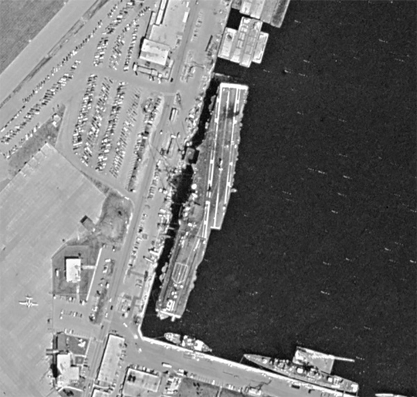
 The carrier USS Ticonderoga served as the Apollo 16 and 17 and Skylab 2 recovery ship. She was decommissioned in late 1963 and is seen at San Diego in April 1974. (credit: NRO via Harry Stranger) |
In 1974, a HEXAGON satellite flying over San Diego spotted two aircraft carriers. One, the USS Constellation, was a sister ship of Forrestal, but based in the Pacific. Another, USS Ticonderoga, was an Essex-class attack carrier. Ticonderoga had been the prime recovery ship for the Apollo 16 and 17 missions in 1972, and the Skylab 2 mission in 1973. The ship was decommissioned in late 1973, so by April 1974, when photographed by a HEXAGON satellite, Ticonderoga was most likely being stripped of useful equipment before being sold for scrap a year later.
 USS Constellation at San Diego in April 1974. The carrier's aircraft have departed prior to the ship arrived at her home port. (credit: NRO via Harry Stranger) |
 The USS Lexington served longer than her sister ships, eventually becoming the Navy's training carrier. She is seen here in 1982 moored at Mayport, Florida. (credit: NRO via Harry Stranger) |
In October 1982, a HEXAGON satellite photographed USS Lexington in Mayport, Florida. Lexington was the last of the Essex-class carriers still in service and used as a training carrier. The ship would continue to operate until the 1990s, when she was retired and eventually became a museum ship in Texas.
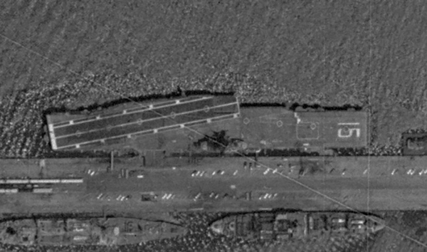
 USS Kitty Hawk was photographed by a HEXAGON reconnaissance satellite in October 1977 heading out to sea from San Diego. The ship had recently been modernized to carry the Navy's new F-14 Tomcat fighter. The distinctive Tomcats were parked at the rear of the flight deck. (credit: NRO via Harry Stranger) |
KENNEN and scandal
In late 1976, HEXAGON and GAMBIT were joined by a new satellite system known as KENNEN. KENNEN was the first digital imagery satellite and it relayed its images to the ground via a satellite link. This meant that the images could reach a photo-interpreter in Washington in under an hour, but for years the quality of the images was not as good as the GAMBIT, and the amount of territory imaged was nowhere as substantial as the HEXAGON.
In 1984, Samuel Loring Morison, an analyst at the Naval Intelligence Support Center outside of Washington, DC, sent three KENNEN images to Jane’s Defence Weekly. The photos revealed a Soviet Union military shipyard in Ukraine. Morison was quickly arrested, tried, and sent to prison. (See “Flattops from space: the once (and future?) meme of photographing aircraft carriers from orbit,” The Space Review, July 19, 2021.) His leak revealed to the world some of the capabilities of the KENNEN satellite, although by this time the Soviet Union knew a lot more about it because another American had sold them a KENNEN technical manual.
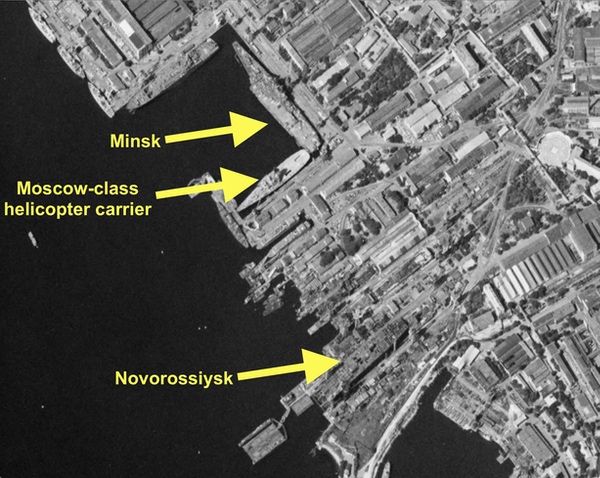 The Mykolaiv shipyard in Ukraine was photographed by an American HEXAGON reconnaissance satellite in September 1977. A Moscow-class helicopter carrier, used to hunt American submarines, was at dock. Also present was the second Kiev-class aircraft carrier Minsk, in late stages of construction. A nearby dry-dock contained the third ship in the class, the Novorossiysk. Minsk entered service in 1978, Novorossiysk in 1982, and the fourth ship in the class took ten years to build and did not enter service until 1987. This same dry-dock was used for construction of the larger carrier Kuznetsov. In 1984, a US naval analyst leaked satellite photos of Kuznetsov under construction and was arrested and imprisoned. (credit: NRO via Harry Stranger) |
Although substantial information about the decision to build the KENNEN satellites has been declassified, no more historical KENNEN images have been declassified. We can assume, however, that the satellites of this series photographed many Soviet warships under construction.
The photos that Morrison leaked in 1984 were of course not the first satellite reconnaissance photos taken of that shipyard. CORONA satellites had photographed it, as did later GAMBIT and HEXAGON missions. In September 1977, a HEXAGON satellite flew over the same Mykolaiv shipyard and photographed several targets of interest to the American intelligence community. One was a Moscow-class helicopter carrier at pier side. The two Moscow-class ships carried helicopters and were tasked with hunting American submarines in the Mediterranean and the Atlantic Ocean. They were notoriously unstable, however, and a photograph of one in heavy seas shows the ship rolling severely to one side. Their crews must have been miserable.
The helicopter carrier was well known to the US Navy by this time. But two other targets in the shipyard were probably of greater interest to intelligence analysts. Docked perpendicular to the helicopter carrier was the second Kiev-class aircraft carrier, named Minsk. The Soviet Union had a penchant for building ships unlike those in any other navy, and the Kievs were a perfect example. They were equipped with vertical take-off and landing fighter jets like the famed British Harrier—although much less capable—as well as anti-submarine helicopters. But they were also equipped with large anti-ship missiles at their bow, giving them a distinct look. Officially, the Kievs were designated “heavy aviation cruisers,” which allowed them to pass through the Turkish Straits without violating a treaty that prohibited aircraft carriers heavier than 15,000 tons from transiting the Straits.
In the HEXAGON image, Minsk’s flight deck was covered with construction equipment indicating that it was unfinished. Minsk would not enter service for another year.
Nearby, in a construction dock, another large ship was being built. Astute photo-interpreters would have noticed the resemblance between that ship and both Minsk and Kiev, which had been built in the same dock. That ship would eventually be named Novorossiysk. Kiev took five and a half years to build, Minsk nearly six years, but Novorossiysk would take seven years and would not enter service until September 1982. These increasing construction times were certainly noticed by American intelligence analysts.
After Novorossiysk left the dock in 1978, the shipyard would begin construction of the fourth and final ship in the class, initially named Baku and eventually renamed Admiral Gorshkov. Gorshkov took nearly ten years to complete and did not enter service until 1987. That ship, now heavily modified and renamed, serves in the Indian Navy.
When Baku/Gorshkov left the dry-dock in early 1982, the Soviet Union began construction of a new and larger aircraft carrier to a different design. As American satellites photographed the facility, the size and layout of this new carrier became apparent. Its difference and new capabilities were why Morrison took note of it when he saw the KENNEN reconnaissance photos.
Eventually that ship would enter service in the 1990s and be known as Kuznetsov. It would become notorious for breakdowns and fires and accidents. Kuznetsov is currently in the Russian Navy and undergoing overhaul, and recently Russia accused Ukraine of trying to sabotage the ship—a bizarre accusation considering that the carrier has been out of service so long that it will probably never sail again. Until it is scrapped or sinks from neglect, it will still show up in satellite photos.
Next: Part 2, aircraft carriers and today’s use of commercial satellite imagery for open source intelligence.
Note: we are now moderating comments. There will be a delay in posting comments and no guarantee that all submitted comments will be posted.