NavIC: India’s “jinxed” navigational program, or a cornerstone of India’s misplaced space priorities?by Ajey Lele
|
| For ISRO, NavIC poses a challenge, since it is not about any single failure but instead a compounding series of technical setbacks. |
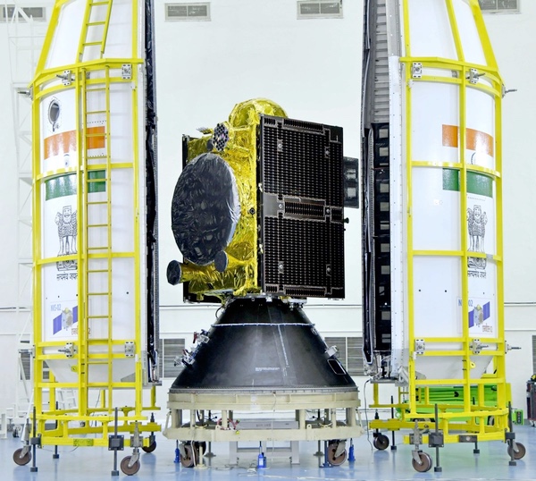
Unlike global satellite navigation systems such as GPS, which deploy satellites in medium Earth orbit (MEO), NavIC is a regional system that uses seven satellites (along with backups) placed in geostationary and geosynchronous orbits. NavIC provides two main services: the Standard Positioning Service (SPS), offering accuracy of about 5–20 meters for civilian use, and the Restricted Service (RS), intended for strategic users. The first satellite in this constellation was launched in 2013, and the system was declared operational by 2018.
Today, NavIC, is facing a major service disruption, with only three satellites currently being functional. A minimum of four functional satellites are required for accurate positioning. Recently, ISRO declared that the atomic clock of the ten-year-old IRNSS-1F satellite has failed on March 13.
This follows earlier setbacks like the flawed launch of the next-generation NVS-02 satellite in January 2025. In a February 25 statement, ISRO announced the outcome of an investigation about this failure. NVS-02 was successfully placed into a geostationary transfer orbit, but failed to reach its intended final orbit because its onboard engine could not fire. The investigation found that a pyrotechnic valve in the engine had failed to open due to a command signal not reaching it, and thus blocking oxidizer flow to the orbit-raising engine.
For a variety of reasons, six of the 11 satellites launched by ISRO for the purposes of navigation have suffered failures or partial failures. Many failures were mainly associated with the problems in Swiss-made atomic clocks. Apart from this, IRNSS/NavIC satellite failures have stemmed from reasons such as engine and valve failures, missed command signals, and aging hardware. Reliance on imported components and insufficient redundancy have further degraded constellation reliability.
The term “jinxed” is scientifically incorrect because it suggests that failures are caused by bad luck rather than identifiable technical issues. In reality, the IRNSS/NavIC satellite failures have clear known causes. Yet, given ISRO’s otherwise impressive track record of successes in other major space projects, the repeated setbacks in the NavIC program are almost making people to think that ISRO’s navigational program is jinxed!
Experiencing failures and encountering malfunctions are not uncommon for space agencies worldwide. However, for ISRO, NavIC poses a challenge, since it is not about any single failure but instead a compounding series of technical setbacks.
All this has made the India’s navigation system dysfunctional, which has both civilian and strategic importance. Amid ongoing military operations in India’s backyard, happening in the Iranian and Afghanistan theatres, the importance of a fully functional satellite navigation system for India has never been clearer. Experiences from India’s own Operation Sindhoor (May 6–7, 2025) had highlighted NavIC’s limitations and the risk of operating with a partially dysfunctional constellation. For, India the challenge is more acute since China provides military-grade BeiDou signals to Pakistan. In the Asia-Pacific region, experts feel that BeiDou’s performance is better than GPS.
Various recent conflicts like Armenia‑Azerbaijan, Russia‑Ukraine, and US/Israel-Iran have shown how unmanned aerial vehicles or drones can decisively shape battles of the day. Beyond-visual-range engagements, precision-guided munitions, joint direct attack munitions, hypersonic weapons, and missile defense systems are now central to modern military conflicts. These military systems rely heavily on accurate, real-time positioning and targeting data. Major militaries all over the world are depending mainly on timely satellite-derived information to detect, track, and intercept threats. Hence, a reliable space-based navigation system is a critical enabler for operational effectiveness and central to battlefield success.
Like other major space programs around the world, ISRO has suffered its share of failures, and there is no assurance that future missions will be free from setbacks. However, the challenges facing NavIC appear to extend beyond purely technological glitches or supply chain constraints. These failures are pointing towards deeper policy and planning issues such as delays in satellite replacement, gaps in constellation planning, delays in indigenous development of atomic clocks, limited redundancy, and slower integration with civilian and strategic users. Essentially, there is a requirement of putting development of this program in a mode with a stronger policy framework, better long-term planning, and clearer prioritization among the other big programs being developed by ISRO.
| Has the success of high-visibility missions like missions to Moon and Mars encouraged a push toward more ambitious, stature-driven projects like human spaceflight without first fully consolidating critical strategic systems like satellite navigation? |
Along with the satellite operations, there have also been problems with the user segment. According to ISRO, the user segment mainly consists of a single-frequency IRNSS receiver capable of receiving the signal at L5 or S-band frequency, a dual-frequency IRNSS receiver capable of receiving both L5 and S-band frequencies, and a receiver compatible to IRNSS and other GNSS signals. It is difficult to realize how a professional organisation like ISRO had sidelined the issues related to the development of ground elements and the user segment during the initial phase of the program. For some years, some of their navigation satellites were idle in space since there was no ground network planed for making the signal available for the common users and this has turned precious investments meaningless.
In fact, the Comptroller and Auditor General of India (CAG) had flagged delays and cost overruns in the NavIC project, noting that the system was not fully operational as of June 2017. According to the report, by March 2017 ISRO had incurred a total expenditure of approximately $375–380 million, including both core program and launch vehicles, satellite maintenance, and ground infrastructure. The system was expected to become widely available in a user-friendly mode by April 2020; however, while NavIC services have since been operational, adoption has remained much limited. Even by 2026, its use on mainstream mobile devices, though enabled in some chipsets, is still not yet prevalent, and common mobile users in India do not have easy access to NavIC.
What do the setbacks in NavIC indicate? Rather than pointing to a single cause, they raise broader policy queries about prioritization and sequencing in regards to the nature of projects undertaken by ISRO. Has the success of high-visibility missions like missions to Moon and Mars encouraged a push toward more ambitious, stature-driven projects like human spaceflight and plans for a space station and mission to Venus, without first fully consolidating critical strategic systems like satellite navigation? Is ISRO “punching above its weight” within limited resources while attention is being spread too thin, creating gaps in core capabilities that have direct strategic and civilian implications? By contrast, major space powers like the United States, China, and Russia have historically ensured that foundational critical space infrastructure like robust navigation, communication, and surveillance systems, is firmly in place before expanding into more symbolic or exploratory missions. The NavIC story should be an eye opener to India’s policy planners, demonstrating the requirement for India to have a sharper policy focus on strengthening strategic necessities first.
Note: we are now moderating comments. There will be a delay in posting comments and no guarantee that all submitted comments will be posted.