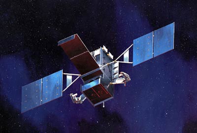
Tactical IR satellites: operationally responsive spacecraft?by Taylor Dinerman
|
| The troops on the ground need information they can use in a timely and easily understood format. Simply to provide them with raw satellite data is probably worse than useless. |
If the DoD is lucky these will also have some secondary usefulness in tracking things like supersonic aircraft turning on their afterburners and maybe even certain surface-to-air missile launches. Years ago one of the missions that SBIRS Low, operating in longer wavelengths than either SBIRS High or DSP, was expected to accomplish was something called “battlespace characterization”. The idea was to use the IR imagery to help examine a battle area. They could determine such things as the intensity of artillery bombardments and other types of firepower. The system was not expected to be able to pinpoint the positions of individual guns or even or batteries. Instead, it provided a tool for historical analysis: intelligence officers could use this data to help determine what happened during a battle in a remote part of the world.
For tactical purposes this is not very useful. The record of the DSPs and other expensive satellites as serious tactical assets is not that great. Of course, that is not what they were designed for. The Air Force and the NRO have traditionally been reluctant to give up too much control of these systems to the Army and Marines. This is understandable since their primary missions involving nuclear warfighting are so important.
The troops on the ground need information they can use in a timely and easily understood format. Simply to provide them, or division or brigade intelligence staffs that support them, with raw satellite data is probably worse than useless. The next generations of US Army and Marine Corps units are going to require information that can be integrated into their “network-centric” information systems. Imagery from space-based infrared sensors that are specifically designed for tactical utility should be part of these networks.
This is a mission for a future constellation of small “operationally responsive” satellites. Part of the constellation should be kept in orbits that take them over places such as south Lebanon or the Afghan-Pakistani border where we can assume that there will be trouble for a long time to come. These should be carefully calibrated on a constant basis, so that their positioning information is ultra-precise. Other satellites can be kept on the ground ready to be launched at relatively short notice to supplement the ones on orbit over the world’s trouble spots, or they could be launched to cover unexpected outbreaks of fighting.
A model for the way such a program could be run is GPS, which, over almost three decades, has gone from prototypes to sets of more and more sophisticated and capable satellites. These spacecraft have, on the whole, been both cost effective and free of the kinds of nasty and expensive surprises that have plagued SBIRS and other Air Force satellite programs.
An operationally responsive tactical IR satellite system would have to be both affordable and based on proven and reliable technology. The first generation of such satellites may not have all the desired features, but if properly designed—with the right filters and the right level of multi- or hyper-spectral sensitivity—such craft would give the ground forces a valuable early operational capability.
| An operationally responsive tactical IR satellite system would have to be both affordable and based on proven and reliable technology. |
To make the program affordable it would have to be designed to use already existing bus and power supply systems and probably also an in-service communications architecture. It would have to be light enough to be launched on a Delta 2 or on a future operationally responsive spacelift vehicle. Most important of all, the funding stream—no matter how much or how little—would have to be predictable so that the contractors would have the incentive to plan for the long term. This would be the most difficult part of the program since it would mean asking Congress to give up part of its power over the annual budget cycle.
Another way to keep the program affordable would be to keep the early requirements to a minimum. The first versions should be strictly for ground force use only, with perhaps some applications for Marine Corps amphibious warfare requirements. Only after the system has proven itself should the program be allowed to move on to develop air-to-ground sensor-to-shooter loops.
Ultimately a constellation of a dozen or so spacecraft in orbit, backed up by a similar number on the ground, would be ideal for the early versions of the full system. The ground segments will have to be as simple and as inexpensive as possible since it will need to be deployed with more than fifty Army and Marine brigade-sized units as well as with higher headquarters.
If the idea of operationally responsive space means anything, it means that the military space forces, particularly Air Force Space Command, are ready to give priority to supporting the troops on the front lines worldwide. Enhancing the combat effectiveness of the Army and the Marines and helping to save American lives should be the highest goal. As Clausewitz put it, “The object of fighting is the destruction or defeat of the enemy.” The more that military space contributes directly to that objective, the better for the troops on the ground and for America as a whole.
