Satellite navigation stumbles forwardby Taylor Dinerman
|
| Galileo is becoming less an instrument of European power or prosperity and more of a high-tech instrument of diplomacy. |
It is interesting to note that the system was designed by the EU and its member governments with little real private sector input. What input there was came from the semi-nationalized and government-dependent aerospace sector, which had no interest in telling their political masters things they did not want to hear. Entrepreneurs and venture capitalists might have given the EU a different perspective on the project. In any case, it is difficult to imagine a viable Galileo business plan that does not break—or at the very least bend to near destruction—the agreement the EU signed with the US in 2004.
India’s decision to go ahead with a regional satellite navigation system is obviously designed to give New Delhi a system that they alone can control. When and if it becomes operational, it will reach from the coast of East Africa to Australia. The primary purpose of this system is to improve India’s air traffic control performance and to improve the overall levels of civil aviation safety. Building it will also improve their skill and knowledge levels and help them get onto the cutting edge of electronic navigation and timing technology.
They are not going to allow themselves to depend on Galileo; in fact, India has been reluctant to sign on to the European system, according to one report, for security reasons. It may be that their system is in part designed to counter the proposed new Chinese Compass system. India may want to be in a position to compete with China in the production and development of low-cost satellite navigation products.
India is maintaining their connection with their traditional Russian friends by investing in Glonass. They will contribute to the system both by launching a few Russian-made satellites on their GSLV or PSLV launchers, as well as by helping to build a new generation of orbital hardware.
India’s growing seapower has made it a major regional force. Except for the US, no power on Earth can hope to carry out naval operations in the Indian Ocean without its permission or at least its forbearance, at least not in the near term. The US considers this a good thing, but the Chinese may not agree, as India sits astride the sea lanes that carry the bulk of China’s oil imports from the Persian Gulf. These sea lanes are controlled by both the US and India, and thus to say that this situation is uncomfortable for Beijing is to put it mildly. Neither China, nor India, nor the US is going to allow itself to rely on anyone other than themselves to provide vital navigation information in this region.
| What is evident is that more and more nations and groups of nations are seeking to develop and control their own satellite navigation systems. |
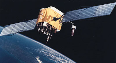
The US GPS 2F satellite program, designed to have a more powerful signal and longer service life than previous models, is behind schedule, but its problems are the normal hiccups that occur with any new spacecraft. Boeing hopes that the first one will be ready for launch in May 2008. With the new civilian signals and higher power the US hopes that by 2012 when all 12 of the Block 2F spacecraft are in orbit the users will be able to achieve sub-meter accuracy, about the same as the Europeans claim for Galileo.
What is more interesting is that the US GPS 3 project, which at one time was seen as the flagship for acquisition reform, is now being reexamined. It may be equipped with optically-pumped cesium atomic clocks which, it is claimed, may equal the accuracy the Europeans hope to obtain with their maser-based timing signals. In any case, thanks to Galileo’s delays the US may have more time to work on an improved GPS 3 system that could negate some or of all the advantages the Europeans hope to gain.
What is evident is that more and more nations and groups of nations are seeking to develop and control their own satellite navigation systems. The motives for this include military needs; special civilian requirements, such as India’s need for a radically improved air traffic control service; and the prestige now associated with satellite navigation. In the future ultra-precise navigation may be part of everyday life. In Europe the Galileo receiver and transmitter chips implanted in cars may be able to tell how fast and where everyone is going. Frankly we don’t have any idea how this technology will impact the world, we only know that it will do so in ways that we can hardly anticipate.
