Billiards in space<< page 1: it’s all about the data Sins of omission and commissionThere is a cacophony of voices from all fronts demanding to know who is to blame for this preventable incident. As is usually the case, there is no single “bad guy” that we can all hang in effigy over this satellite collision. Instead, there is plenty of blame to go around for all involved. A large portion of blame can be laid at Iridium’s door for not exercising the same degree of caution and safety shown by other satellite owner-operators. Clearly, Iridium cannot claim that they were unaware of the collision risk to their satellites. At a forum organized by the George Marshall Institute in June 2007, John Campbell, the Iridium vice president for governmental affairs, stated that the debris field from the Chinese anti-satellite test had increased the number of “serious conjunctions” on the Iridium constellation by 15%. He also stated that the JSpOC was giving them daily warning of close approaches, with over 400 approaches within 5 kilometers being reported each week over the entire Iridium constellation. Further comments as to what Iridium was doing about these close approaches given at the same forum are distressing. Campbell questioned the error in those warning reports and their usefulness for avoidance maneuvers:
There is definitely something amiss here. Clearly, if the JSpOC was screening the Iridium constellation daily for collisions using the same high precision methods used to protect the military and NASA satellites, then the quality of the data would have been good enough to make avoidance maneuver decisions, just like NASA, the military, and CNES. This leads me to believe that Iridium was not getting the high accuracy screening.
Low accuracy screening of the entire satellite catalog using just the publicly available TLEs is already available publicly from the SOCRATES service provided by the Center for Space Standards and Innovation. However, on the day that they collided, the Iridium-Cosmos conjunction wasn’t even listed in the Top 10 most dangerous conjunctions for that day: SOCRATES calculated it to have a miss distance of just under 600 meters. This error is due to the inaccuracy of the publicly available TLEs used to perform the analysis. It also appears that either Iridium or the JSpOC terminated the collision screening for the Iridium constellation at some point between July 2007 and the collision in February 2009, as Iridium has made repeated public statements that they did not receive any warning. Likewise, the US military has stated that they did not have any warning. The following additional comment by Campbell at the same event may shed some light as why this happened:
Basing the protection of the largest low Earth orbit constellation of satellites on such a theory, even when there is a significant amount of data showing that it could be false, leads one to question the decision-making process involved. Perhaps Iridium decided that they could not afford the resources to deal with the decision-making and maneuver planning to properly operate their satellites in a safe manner. If that is indeed true—and there is no known hard evidence either way—then they placed the short-term financial well being of one company over the long-term welfare of all. In my formative years I attended a Catholic elementary and high school. One of the theology lessons that were driven into my head was the difference between a sin of commission and a sin of omission. In the Catholic doctrine, a sin of commission is one where you know what the right thing to do it but do the wrong thing anyways: you commit a sinful act. In situations where there is a recommended “good” act that should be done which is not, it is said that you omit a good act (and thus sinned anyway). In this vein, I think it can be argued that the US military committed a sin of omission in the case of the Iridium-Cosmos collision. The US military maintains the best and most complete satellite catalog in the world and had the data to provide collision warning to Iridium. But as was discussed earlier in this article, the US military only looks at a limited list of satellites for collisions. It also appears that at some point they stopped providing collision warning for the Iridium constellation. Given the complexities of the conjunction assessment process, it is understandable that the US military does not have the resources or capability to screen all of the estimated 900 payloads in Earth orbit. But both the US military and Iridium knew that there were many close approaches with the Iridium constellation and that eventually one could collide. Perhaps both thought that if they stopped looking at the problem it would go away. There are also legitimate questions to be asked of the US military as to what role was played in this whole situation by years of inadequate investment in infrastructure, low budget priority, personnel shortages and training cutbacks, especially when combined with the recent move from Cheyenne Mountain to Vandenberg. The debris problem has been well known for many years, and after the Chinese anti-satellite event the US government was one of the most vociferous voices bemoaning the sorry state of Earth orbit as a result. Perhaps the actual funding and priority of space protection did not match the political rhetoric.
Russia is not completely innocent in this situation. It left a non-functioning satellite in an orbit that intersects many other satellites, well after the dangers of orbital debris had been recognized by the world community. It is also interesting to note that it was Russia who launched Iridium 33 into orbit as part of a “seven-pack” of Iridium satellites from the Baikonur Cosmodrome in 1997 and Russia who failed to register it with the United Nations Office of Outer Space Affairs in accordance with the 1976 Registration Convention. Noncompliance with this binding treaty could be grounds for negligence, should this event become a legal matter. Last, a portion of blame should be placed squarely on those policymakers and pundits within the United States who have placed the dogma of security, secrecy, and unilateralism above the collective good. These individuals have been adamant that the US military must tackle this problem itself and will not share the data and tools with other space actors, lest it somehow degrade the national security of the United States. At the same time they also failed to give the US military the appropriate resources to prevent incidents like this. They have also stagnated and stymied the creation of new space security structures that could increase the safety and security of all actors in space, including the US military, solely on the basis of ideology. Options and recommendationsSo what can be done about this situation? While this problem is not necessarily the fault of, nor needs to be solved by, the United States, given its dominance in resources to tackle the problem and desired leadership role in space, I feel America is the place to start. All solutions to this problem revolve around access to space situational awareness data, and my personal opinion is that the United States has three options based on that. Option 1 is to release the high-accuracy SP catalog publicly for all to access. This would allow all satellite owner-operators to do their own conjunction assessment and collision avoidance. There have been debates about doing this within the military before. The arguments against this option is that releasing such data could reveal the capabilities and limitations of the US military’s space situational awareness system and provide the data with which potential adversaries could use to target space assets. But this is potentially the quickest solution. Option 2 is to continue to keep the SP catalog private and for the US government to perform collision warning for all owner-operators. This is entirely possible, but it would require a significant increase in the resources currently allocated to these processes, primarily in the number of trained analysts. It would also require a policy debate over whether or not the military is the right department to be performing this task, as well as what the inherent liability and legal issues are. It would also have to consider the international actors that have concerns about working with the US military, and whether they would have incentive to still develop their own system and methods. Option 3 is for the US government to allow, and preferably support, the creation of an international civil space situational awareness system. This system would have the goal of providing the basic tools necessary to enable conjunction assessment and collision avoidance by all space actors. These tools include positional data on objects in orbit, space weather data, atmospheric density, and the analytical tools to make decisions based on this data. It would also involve contributions of data on precise positions and possibly future maneuvers by commercial owner-operators.
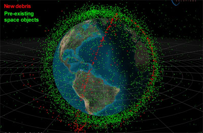
Such a civil system would different from military SSA in that it would not provide characterization information on the satellites nor information on capabilities and intent. It would be focused only on providing the location of objects in space, along with a point of contact for that object, and space weather data. Also, it is not necessary for governments to reveal the locations of their sensitive military and intelligence satellites in such a system. However, hiding the location of these satellites implies that their respective governments have accepted responsibility for keeping those satellites from colliding with others. And there is incentive for governments to do this: allowing your “invisible” satellite to collide with another object defeats the purpose of such a critical asset in the first place. The key to such an international civil SSA system is the data sharing model. While a completely open system where data is available to everyone around the world might be the ideal, failing to give consideration to the sensitivities of such data would probably doom such a system before it even got started. Any data sharing model for this purpose needs to appropriately balance security and privacy with data dissemination and openness. To encourage participation from the essential actors in the beginning, it would probably be necessary to start with a more restrictive data sharing model than what might be possible in the later stages once participants become comfortable with the system and each other. The primary incentives for such a system are twofold. First, since the problem of maintaining space situational awareness fundamentally requires a geographically distributed network of sensors, many states contributing data from a few of their own sensors can provide global coverage for much less cost than one state trying to build an entire network alone. Second, such a system would provide both the data and analytical tools to all space actors, not just those with the resources to build their own tracking networks. This last point is perhaps the most important justification for such a system. The collision on February 10 was between satellites from the two nations with the best tracking networks and satellite catalogs in the world. There are now 40 different nations operating satellites in Earth orbit and many of those have zero indigenous SSA capability. The problem we should be trying to solve is not how to keep a co-orbital anti-satellite weapon from destroying a US military satellite in Earth orbit. Rather, it’s how to prevent an Iranian satellite from colliding from German satellite, which maneuvered to avoid a piece of Chinese debris, thus creating a piece of debris which collides with a US military satellite. The latter is a far more likely scenario, and has much more significant consequences for all actors in space. Iridium’s vice president stated that their approach to the collision problem was to “grit our teeth and hold our breath; that’s our action.” Clearly, the world needs a better plan that that if we are to ensure the long-term sustainability of Earth orbit and continue to derive benefits from it. Home |
|