INSAT-3D and India’s new emphasis on meteorologyby Ajey Lele
|
| One of the major reasons India chose to invest in space technologies was to offer assistance to its agriculture sector. |
The India Meteorological Department (IMD) is responsible for the prediction of weather to assist its farmers, aviation industry, and various other sectors of socioeconomic relevance. IMD came into existence in 1875, nearly 75 years before India got its independence from British colonial rule. One of the major tasks of the IMD is monsoon prediction and it started issuing monsoon forecasts in 1882. Presently, IMD issues a long-range monsoon forecast each April, almost three months in advance of the monsoon season, and continuously updates it during the season. IMD has a huge network of weather observatories all over the country, in the mountains and even the oceans. This organization is involved in various activities from aviation weather forecasting to ozone layer monitoring to tsunami and earthquake predictions and monitoring. It uses satellite technology, radar technology, supercomputers and a number of other state-of-art techniques for weather observations and monitoring. It uses conventional and numerical weather prediction (NWP) techniques for forecasting. Apart from monsoon forecasting it has also mastered the art of tropical cyclone (hurricane) prediction.
One of the major reasons India chose to invest in space technologies was to offer assistance to its agriculture sector. India started its space program in 1963 in a very modest fashion by launching sounding rockets to study upper atmosphere. India established its Indian National Satellite System (INSAT) program in 1983. During its initial phase, INSAT series satellites were developed as multipurpose satellites with multiple payloads. Invariably, all these satellites had a meteorological payload on board. This was mainly done because India was not in a position to financially afford a dedicated satellite only for meteorological purposes. Also, India had become a spacefaring nation only during 1980 and thus was in a period of learning and experimentation. Now, after three decades, the launch of a very sophisticated satellite like INSAT-3D indicates that India has come a long way in this field.
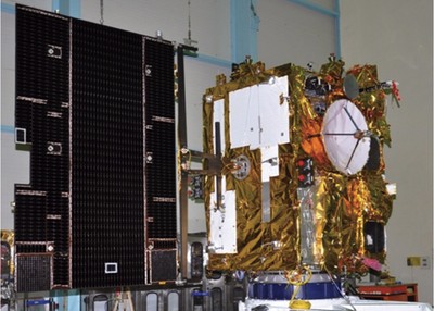
INSAT-3D is an advanced weather satellite configured with an improved imaging system and atmospheric sounder. The other Indian weather satellites, KALPANA and INSAT-3A, provides imagery in visible, near-infrared, shortwave infrared, water vapor, and thermal infrared bands. INSAT-3D, though, offers significant improvements over its predecessors. It offers the imaging in the mid-infrared band to provide nighttime pictures of low clouds and fog. Significant improvements in the quality of sensors have taken place during the last decade and, along with cloud pictures, INSAT-3D also can measure the sea surface temperature with much better accuracy.
In addition, INSAT-3D adds a new dimension to weather monitoring through its atmospheric sounding system, which provides vertical profiles of temperature (40 levels from the surface to about 70 kilometers), humidity (21 levels from the surface to about 15 kilometers), and integrated ozone from the surface to the top of the atmosphere. The satellite also has a data relay transponder onboard to collect weather observations from automatic weather stations located at inaccessible areas in deserts, mountains, and bodies of water. IMD and ISRO have already established over 1,800 data collection platforms at various remote places in India. Another key payload of this system is the search and rescue unit, which will pick up distress beacons from users on land, sea, and in air during emergencies. India’s neighbors and islands in the Indian Ocean region will also benefit from this system.
It is important to visualize the launch INSAT-3D in a larger framework. For last few years, India has been making investments in various satellite systems that could enhance the country’s observational capabilities in respect to various atmospheric parameters, and to assist in improving various forecasting models.
Two missions launched by ISRO in the recent past should be viewed in this framework. On February 25, 2013, India successfully launched its PSLV-C20/SARAL mission. The main payload of this mission was the 409-kilogram SARAL (Satellite for Argos-3 and Altika). SARAL is studying the circulation of ocean currents and also measures sea surface heights, for which it has an altimeter onboard. This information is important to predict the development of weather systems. SARAL has two independent payloads (developed by the French space agency CNES): Argos-3 for data collection, and the Altika altimeter for measuring sea surface height. These payloads were integrated into a satellite bus from India and the entire satellite was built in India. The data received from SARAL supports the French program of operational oceanography development. The data collected also contributes to the Global Ocean Data Assimilation Experiment (GODAE), the first international operational oceanography experiment. SARAL is one of the very few such ocean-centric satellites specifically developed for studying sea surface heights. It is somewhat similar to ISRO’s Oceansat-2, a satellite launched in September 2009 to study surface winds and ocean surface strata. The inputs provided by Oceansat-2 assisted NASA in monitoring Hurricane Sandy in October 2012.
| These satellite launches undertaken by India in recent years indicate that a major focus of India’s space program is the study of weather, climate, and associated issues. |
Nearly a year and a half earlier, on October 12, 2011, India’s PSLV-C18 successfully launched a 1000-kilogram Indo-French weather observation satellite called Megha-Tropiques (Megha means clouds in Sanskrit, an ancient Indian language, and Tropiques means tropics in French). Presently, this satellite is providing data on solar radiation, humidity and temperature profiles, cloud features, and precipitation patterns, among other features. It, like SARAL, operates in polar orbit. India now has the largest civilian remote sensing satellite constellation in the world with 11 operational satellites. These satellites provide images in a variety of spatial resolutions, supporting agriculture, water resources, environment, forestry, drought and flood forecasting, ocean resources, and disaster management.
These satellite launches undertaken by India in recent years indicate that a major focus of India’s space program is the study of weather, climate, and associated issues. For this purpose, India has created a system by positioning satellites in geostationary and polar orbits and also using relevant (direct or indirect inputs) from satellites launched for other purposes.
India’s geography puts it at a disadvantage in regards to adverse weather and climate. The country has faced the worst form of natural disasters in the recent past. Peninsular India shares its northern and eastern borders with the Himalayan mountain ranges, a tectonically active region. Glaciers in these ranges are found melting at a rapid speed in recent times. Due to its geography, India is affected by both tropical and subtropical weather systems, making weather prediction more challenging.
A little over a month ago, the Uttarakhand region in the northern part of India suffered a major natural disaster. The flash floods following heavy rains on June 16–18 had forced the Indian government to launch one of the biggest relief and rescue operations in recent times. This disaster killed thousands, and the India’s security forces, civil rescue workers, and the disaster management agency rescued an estimated 100,000 people. The mammoth physical effort by these agencies was supported by appropriate weather “nowcasting” and short range forecasting. This became possible due to variety of factors, including the inputs received from the disaster area about weather and topographic conductions, inputs received from radars and satellites, and usage of Geographical Information Systems (GIS) tools.
| India requires a vastly improved meteorological satellites regime to arm itself for addressing various challenges and there are high expectations from ISRO in this regard. |
The Indian Network for Climate Change Assessment (INCCA) report of 2010 provides an assessment of impact of climate change in the 2030s on India. According to this report, the anticipated impacts of the climate change in India are likely to be increased temperatures, changes in precipitation patterns including monsoons, rises in expected sea levels, and melting of Himalayan glaciers. Obviously to address the challenges posed by such possible changes, it is important to continuously monitor the atmosphere. India is also witnessing rapid economic growth and a significant amount of foreign investment. Various ongoing infrastructure projects including dam building, mining, and exploration of natural gas could have some long-term bearing on the atmosphere in general, while the execution of these projects requires timely weather inputs. Water scarcity is rapidly becoming a cause of concern in various parts of India. For effective implementation of water resource management, meteorological inputs are necessary. The tourism sector is another sector that is significantly dependent on climatic conditions.
In regards to issues related to global warming and climate change, there is a criticism of India’s position from certain quarters. Now, having a group of weather satellites at its disposal, India could be in a position to present to the world the correct facts about the weather and climate in their region. This could bring in more transparency towards making climate assessments and drawing conclusions.
India requires a vastly improved meteorological satellites regime to arm itself for addressing various challenges and there are high expectations from ISRO in this regard. India needs to continuously make investments to create state-of-art space assets for meteorological purposes. The launch of INSAT-3D is expected to add a new dimension to weather monitoring over the country but much more still needs to be done.