Time for common sense with the satellite catalogby Charles Phillips
|
| It has been very obvious for a long time that many of the decisions that keep information hidden have been made arbitrarily and actually make it more difficult to do things like maintain the official Satellite Catalog. |
First we should note that the US government has excellent reasons for hiding the missions of certain satellites and has legitimate reasons for not making our adversaries’ work easier by giving them information that they cannot easily get themselves. As a former Air Force Squadron Security Officer, I have been trained in the procedures for maintaining secrecy and I have some knowledge about why we would keep some information secret. One key concept is that the US government cannot confirm or deny reports in the media; the media does make mistakes and there is no need to correct those that help keep our operations secret.
Still, it has been very obvious for a long time that many of the decisions that keep information hidden have been made arbitrarily and actually make it more difficult to do things like maintain the official Satellite Catalog. Just in the last few days, General John Hyten, head of Strategic Command and former heas of the Air Force Space Command, said in a speech2 that “capabilities” were classified too high. Hopefully this is the beginning of some common sense in deciding what should be and should not be classified.
Types of satellites
The orbital parameters of many satellites are withheld from the general public. These parameters are normally given as Two Line Element sets, or TLEs. This format dates back to the early days when these orbital parameters were distributed on Hollerith cards: each card held one line of data. The Air Force center that maintains the Satellite Catalog was, until recently, the Joint Space Operations Center (JSpOC) in California. They just renamed it the 18 Space Control Squadron (SPCS), so I may use those two names interchangeably in this article. The organization has had a number of reorganizations over the last many years but apparently this time the Air Force just changed their name.
For the purposes of our discussion there are two levels of security that affect the kind of information that the Air Force releases. Some TLEs are classified as For Official Use Only. These satellites’ missions and general orbital parameters are neither Secret nor disguised. One example is the Defense Meteorological Satellite Program (DMSP).3
The other level is satellites whose missions and orbits are actually classified, like various intelligence collection satellites. The US government legitimately should not identify which satellites have these intelligence collection missions and should not make the TLEs of recent satellites public. They also legitimately classify other objects that fly with them, such as upper stages. That helps hide which is the actual payload.
There are many satellites that have a Secret (or above) mission: photographic satellites, electronic intelligence satellites, etc. Let’s further separate these satellites by their orbits.
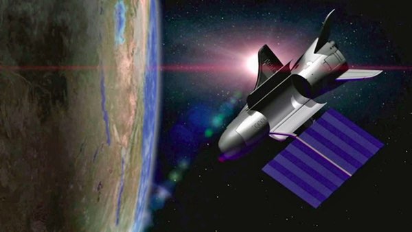
The low Earth orbit (LEO) satellites are mostly electro-optical and synthetic aperture radar imagery intelligence spacecraft. The military normally has an X-38B Orbital Test Vehicle (OTV) in space as well, it has wings and a payload bay and is sort of like a small shuttle. A little higher up are satellites such as the NOSS (Naval Ocean Surveillance System), which are missions that (currently) have two satellites working together. As they orbit they pick up radio, radar, and other signals from below; the two satellites’ signals allow analysts to find the location of the emitter below.
| There are many commercial (mainly optical) tracking systems today and there are lists of satellites that they are tracking that are not in the Satellite Catalog. |
Another type of satellite is in an orbit that has a low perigee and a much higher apogee. This could be a satellite that is in an orbit that allows it to transfer a payload into a geosynchronous orbit. This is referred to as a geosynchronous transfer orbit (GTO) and is very eccentric. But something in GTO would have an inclination which is small, allowing the apogee to be near the geostationary orbit used by many communications and other satellites. But many of these eccentric orbits also have very high inclinations, which allows the satellite to dwell at apogee over the northern or southern polar regions. It is sort of like having a geosynchronous satellite that can observe the polar regions. The orbit is sometimes called a “Molniya” orbit after the Soviet satellite that popularized it.
Just for completeness, there are many military satellites that are not classified and their TLEs are openly distributed. For example the Global Positioning Satellites (GPS) or other similar satellites.
Tracking systems are no longer all owned by governments
We must remember that many countries have sophisticated satellite tracking systems today, including Russia and China. Now they do not have the coverage around the world that the US (and allied) system has, and so it is easier to “lose” some satellites. For many high-inclination, high-eccentricity satellites, the apogee is over Russia or China and so they can get some good tracking of them in a part of their orbits. But it would be hard for them to track those objects at perigee, and good tracking across the entire orbit makes it easier to generate accurate orbital parameters.
A significant recent change is the rapid growth of educational and commercial satellite tracking networks and alternative satellite catalogs. There are many commercial (mainly optical) tracking systems today and there are lists of satellites that they are tracking that are not in the Satellite Catalog.4 Increasingly, commercial operations such as the Commercial Space Operations Center (ComSpOC) can do many of the things that the 18 SPCS can do, and without many of the limitations that the military (such as classification) has. They can also track many classified satellites. From discussions with people who work with them, they know about the classified satellites, they track them, but they essentially pretend that they don’t know what they are. The commercial operators do tell the 18 SPCS about mistakes that the Air Force has made and apparently the Air Force does accept some corrections.
An alternative satellite catalog that is often more complete than the official one is maintained by Jonathan McDowell, who is also well known as the author of Jonathan’s Space Report. The absence of some orbital parameters in the official satellite catalog mostly serves to draw attention to them.
So why release these orbital parameters?
By releasing these orbital parameters, the Air Force could help themselves improve the quality of the Satellite Catalog. That catalog is adequate at best, and even I have corrected some satellite identifications in it. In 2014 they had ArduSat-1, ArduSat-X, and Pico-Dragon misidentified and I pointed this out; later they corrected them. Just getting this minor correction was a lot of work and also caused someone with a very thin skin to send me an email, so I have not tried to correct others. There have been lots of reports of other organizations pointing out errors that apparently have been corrected. Also a number of objects have been documented as reentering the atmosphere, and so are no longer in space, and yet the Satellite Catalog does not state that fact. That issue will be discussed later.
Having unavailable orbital parameters also appears to cause other government organizations to miss things. If something happens involving satellites where the orbital parameters are not available, apparently the event could be missed. One example is object number 22259, a payload deployed by the STS-53 shuttle mission. The orbital parameters for the upper stage also are not available, and it (object 22519) appears to have shed pieces. On that mission, the payload object number is 22518, and the name is given as USA 89. The Air Force maintained satellite catalog has eleven pieces of debris that have “International Designators” that indicate that they came off of object 22519. That should generate an entry in the NASA list of “breakups” and yet it is not there. The latest version of the NASA document is 20085 and the object numbers of those pieces indicate that they were shed well before that (certainly before July 5, 1997).
Similarly, object 20164 was another shuttle flight, and the associated payloads deployed are object 20167 and 20172. An associated upper stage is object 20344, so 20167 stayed in LEO for a while before boosting into a higher orbit—that is why the object number for the upper stage is higher. 20172 has since decayed and so must have been a smaller, secondary payload. After the upper stage delivered the payload to the Molniya orbit, it was cataloged as 20344 in very late November of 1989 and appears to have shed pieces before December 9, 1992. There is no entry for this in the NASA list of breakups and anomalous events.
So it might also help governmental agencies include important events in common reports. Certainly it has to be inconvenient to have both unclassified and classified lists of satellites. It must be more difficult to follow some of the classified satellites and so, when they shed pieces, they are not noticed.
| Many objects should have their orbits released to improve safety when they reenter the atmosphere. |
With the orbital descriptions, what could the community do? These example satellites are high-inclination, high-eccentricity objects, according to the amateurs who track them, and are hard to track most of the time. The 18 SPCS could release the orbital parameters without identifying the missions, and could have some very talented people potentially helping them. If someone looked for an object and it did not appear, they would likely inform the Air Force. If one shed pieces the community could alert NASA. These talented people would bring some “corporate knowledge” to the task.
Perhaps if the DMSP constellation’s orbits were more widely available, the NASA breakup list might be more complete. My earlier story here documents a number of times that the DMSP satellites have shed pieces, events that are not captured in the NASA list of events of that type (see “Satellite breakups and related events: a quick analysis”, The Space Review, January 23, 2017). NASA does capture similar events for the unclassified NOAA Polar Orbiting Environmental Satellite system.
And, last but not least, many objects should have their orbits released to improve safety when they reenter the atmosphere. When satellites reenter, they can drop significant pieces to the ground. The predicted impact point will always be imprecise but we can identify a track below the orbit where pieces may fall. One of the first such events I worked on as an Orbital Analyst was the reentry of Skylab. We sent many alerts about possible points where governments might expect falling debris
When objects for which the orbits are not released re-enter, the warnings about this event are absent. People on the ground do not get appropriate alerts about possible heavy items descending from above. These falling objects have not yet injured anyone, but the risk is not worth the marginal benefit to security, and more events like this will occur. The best documented reentry in this class was object 32707, International Designator 2008-010B, a Centaur upper stage that reentered in November of 2015, impacting in southeastern Spain.6 From exchanging email with the author of that report, Ted Molczan, just a small change in reentry location could have put those pieces onto inhabited areas. People could have been injured or killed for no increase in secrecy. Ted Molczan also details a similar event with object 35939, a Delta II upper stage that reentered over Mongolia.
When items like this decay from orbit, the Satellite Catalog is also often not updated: both object 35939 and object 32707 are not shown as decayed in spite of the fact that the Air Force has picked up pieces from one of those events in Mongolia. This adds more errors to an already flawed catalog.
And the Air Force is not always consistent: object 23098, International Designator 1994-026B, was a Centaur upper stage that decayed, and the Satellite Catalog shows that it decayed. The orbital parameters of this object and the associated payload have not been released; it seems that the rules for maintenance of the official Satellite Catalog have changed. How was this object different from the other two, or was it decayed by mistake?
Which orbits could be released?
Which satellites should have their orbital parameters released? First is the DMSP constellation: they were classified above the Secret level when it first started but, likely because the information was so valuable and the source of the information was so hard to conceal, their missions and orbits were declassified years ago. When I was an Orbital Analyst we distributed their TLEs in our unclassified sets and many of the older satellites are still in those sets. Sometime in 1990 the new satellites’ TLEs were assigned a status of For Official Use Only by someone. This accomplishes nothing since there is no way that an adversary could use these TLEs to conceal any operations from us—and the satellites are large and very easy to track. The DMSP program will also end in a few years when the final satellites fail.
| Just in case they make even simple mistakes, let’s keep the very low altitude photographic reconnaissance satellites classified, even though they are easy to track and certainly everyone has acceptable orbital parameters for them. |
Past and future OTV flights should be declassified as well: this object is so large that it is easily tracked. Next would be long-retired high-inclination, high-eccentricity objects—the US satellites that fly in Molniya orbits. Most of these are electronic intelligence satellites that gathered radio and radar signals from Soviet and Chinese sites that are at high latitude. The satellites’ missions would not need to be revealed, just their orbital parameters. These objects are in the Satellite Catalog right now but their orbital parameters are blank.
Geosynchronous satellites that are stationary could be released since their relative motion in relation to a ground site is low. When the lighting is good, an optical telescope can just sweep the Equatorial geosynchronous belt and see a number of satellites. Some of them do have some eccentricity and so appear to follow a figure-eight in the sky, yet they don’t stray far from the Equator. They really cannot hide.
The other ones
Which satellites might not have their orbital parameters released? We have to admit that every one of our reconnaissance satellites will be tracked, and there is no way to hide them. However, our adversaries may take precautions when a payload is in sight of their facilities. They could have easily mistaken an upper stage for a payload, and might take precautions at the wrong times. I was stationed at a Ballistic Missile Early Warning Station at Clear Air Force Station, Alaska, and have seen the radar returns from many objects in space. The return from almost all payloads stands out from the return from an upper stage, as the payload is far more stable. The return from the upper stage changes a lot more. But it is easy to misidentify the radar track (our radar operators frequently did) and our adversaries are likely to do that. If they had misidentified the payload and upper stage, let’s not tell them about that until the payload is retired.
Just in case they make even simple mistakes, let’s keep the very low altitude photographic reconnaissance satellites classified, even though they are easy to track and certainly everyone has acceptable orbital parameters for them. When these satellites correct their orbits they might be missed and it could take a few days to find them again. GTO or geosynchronous satellites orbits that change could also be concealed in the satellite catalog in case our adversaries lose them.
Acknowledgement
The author would like to thank Ted Molczan and Jonathan McDowell for their hard work and success in making more complete satellite information available to the public. Their innovative efforts have filled in many gaps in the Satellite Catalog and have explained a number of the events that affected many people on the ground.
Endnotes
- “Going Blind: Why America is on the Verge of Losing its Situational Awareness in Space and What Can be Done About It” September 10, 2012 Brian Weeden Secure World Foundation
- “Declassification and partnerships needed for better space defense, Hyten says,” SpaceNews, April 6, 2017.
- A History Of The Military Polar Orbiting Meteorological Satellite Program, R. Cargill Hall, Office of the Historian, National Reconnaissance Office, September 2001
- “Going Blind” page 8 – there are many satellites, as identified by ESA, that are tracked but are not in the official Satellite Catalog. Some of these may have been corrected.
- History Of On-Orbit Satellite Fragmentations, 14th Edition, June 2008. NASA/TM-2008-214779
- “Re-Entry Sightings and Debris Recovey of 2008-010B Spain - 2015 November 03 UTC” Ted Molczan, Journal of Space Safety Engineering, Vol 2, Number 2, December 2015.