|
|
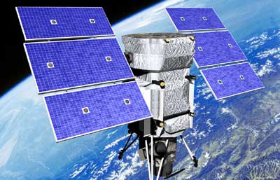 High-resolution commercial remote sensing spacecraft already exist or are in the planning stages, like WorldView (above), but their capabilities pale in comparison with what future systems could provide. (credit: DigitalGlobe) |
Spysats for profit
by Sam Dinkin
Monday, May 9, 2005
Photo reconnaissance—from aircraft or satellites—has played a major role in world affairs, from the Cuban Missile Crisis to the recent revelation that North Korea appears to be planning an underground nuclear test. However, we may be seeing a small beginning of a growing consumer retail satellite imagery market. With Google’s purchase of Keyhole, we may see some innovation in this area.
Additionally, mounting a 16-megapixel CCD on a geosynchronous satellite can get much sharper images than old-fashioned weather satellites. There’s an Australian firm, Astrovision Australia, that presented at Space Access ’05 who wants to broadcast high-definition real-time overhead shots to everyone’s 3G phone. Combine high-resolution weather imagery with IBM’s Deep Thunder supercomputer to predict what the weather is going to look like in the next hour and you may have the 3G killer application that drives North American adoption.
Keyhole would rather not be perceived to be too snoopy:
There is little reason for people to be paranoid about the satellite maps because the images generally are six to 12 months old, said John Hanke, Keyhole's general manager. "And it's not like you are going to be able to read a license plate on a car or see what an individual was doing when a particular image was taken," he said.
Nonetheless, such capabilities offer interesting applications. With sub-meter resolution, why not require cars to have their license plate numbers on top? With four pixels with a 256-level gray scale, that is 32 bits of data or enough to uniquely identify 4 billion cars. To identify the cars while they are parked requires those pixels to be ordered. If the lowest bit on each pixel is always 1110 or 0001, it breaks the symmetry and gives us 29 useful bits. Five hundred million cars should be plenty for the US. The plates do not have to be human readable—the color differences could be in non-human wavelengths.
| Combine high-resolution weather imagery with IBM’s Deep Thunder supercomputer to predict what the weather is going to look like in the next hour and you may have the 3G killer application that drives North American adoption. |
Having unique identifiers in conjunction with constant overhead surveillance would make it more difficult to pull off a crime spree like the Washington, DC sniper serial killer in 2002. The constant overhead sub-meter surveillance could potentially be done from airships or radio towers in some cities. Britain has been using closed circuit outdoor TV for crime prevention for some years. It may be a while before we get a sea of cheap local cameras so overhead timesharing may be the best we can do for a while.
Satellite surveillance could potentially do it, but that is a lot of pixels to cover at 50 or 25 square centimeters resolution. The CCD could handle time division multiple access between many different locations that needed to be looked at. The trick would be moving the focus fast enough and not spending too much energy moving the satellite.
Perhaps an installation on the Moon would be able to scan the most interesting parts of America for a few hours every day. The densest 40 million homes could be scanned once every 3 minutes or so (50,000 square kilometers times four million grid points per square kilometers, divided by 16-megapixel CCD at 60 frames per second). Gathering imagery from the Moon probably makes more sense than displaying it (See “Buy the light of the Moon”, The Space Review, August 30, 2004).
As for what would an individual might be doing if their car was found parked in front of someone else’s house overnight, it might be something like an episode of “Desperate Housewives”.
Sam Dinkin is a regular columnist at The Space Review. He is also trying to start SpaceShot, Inc. and has a similar story about himself. He can be reached at (888) 434-6546 and thespacereview@dinkin.com.
|
|