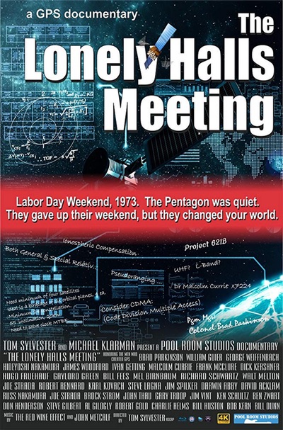
Review: The Lonely Halls Meetingby Richard Easton
|
| However, the film has many errors and distortions. Two primary source documents from just after Lonely Halls call into question the thesis that GPS was invented then. |
On a positive side, it is valuable to hear the interviews with the many participants. I have wondered for some time what the perspectives of the other participants would be about Lonely Halls. The interviews with Colonel Gaylord Green are especially enlightening. The documentary has good graphics and expertly explains important GPS concepts. It properly credits the JPO for implementing CDMA (Code-Division Multiple Access), developed by Jim Spilker, as the GPS signal which was a significant advance and helped make it a success.
However, the film has many errors and distortions. Two primary source documents from just after Lonely Halls call into question the thesis that GPS was invented then. Naval Research Laboratory participants disagree about the importance of Lonely Halls. Other people (Harry Sonnemann and Keith McDonald) who worked on satellite navigation systems prior to 1973 also dispute this. None of these voices are heard in the documentary. In addition, there are huge problems with the description of Timation. This was the satellite navigation system started by my father Roger Easton in 1964. In the interest of clarity, I will briefly summarize the problems and put additional material in appendices.
Three people are commonly listed as the fathers of GPS: Dr. Bradford Parkinson of the Air Force, who is given the credit in this program, Roger Easton from the Navy, and Dr. Ivan Getting from Aerospace.
The documentary asserts (at the 3:18 mark) that the first time anyone thought of using satellites for navigation was on October 7, 1957. This is false. There are at least four different pre-Sputnik examples of people discussing the use of satellites for navigation. In 1869 Edward Everett Hale serialized in “The Atlantic Monthly” The Brick Moon about using satellites for navigation. The Naval Research Lab’s 1955 proposal for what became Project Vanguard, co-written by Roger Easton, mentioned navigation as a possible use of artificial satellites. In 1956 Lovell Lawrence wrote an article about it and a letter from Arthur C. Clarke forecasted a global navigation system within 30 years.1
The documentary confusingly calls Transit, the navigation system invented at APL by Guier, Weiffenbach, and McClure, the first GPS system. This is incorrect. Transit was a Doppler system and was never called GPS; however, it did provide a global two-dimensional navigation capability for stationary users and submarines that compensated for their motion using their sophisticated inertial navigation systems. Land vehicles in motion, and especially airplanes, could not use it. The Joint Chiefs of Staff promulgated in 1968 The JCS Master Navigation Plan for an improved navigation system that would be global, all weather, always available, and three dimensional with a specified accuracy (I’ve never been able to find the original document but think that it was 50 feet.) It was called the Defense Navigation Satellite System [Development Program]. In the fall of 1973 it was renamed GPS.2
| An important feature of GPS are the atomic clocks in the satellites. Parkinson claims that, “The Navy tried to do this and were unsuccessful.” This is simply not true! |
At the 21:21 mark of the documentary, a slide shows Project 621B versus Timation (TIMe navigATION). Walt Melton states that an expansion was proposed for increasing Timation from 12 to 157 satellites, which was necessitated by the Timation satellites being several hundred miles above the surface of the earth. This confuses Timation with Transit. Transit satellites orbited at about 700 miles. Timation satellites in its operational navigation system, like GPS, were always planned to be in medium Earth orbits. The first two Timation satellites were at about 550 miles but that was due to cost considerations.
Ron Beard commented that:
The Navy (OPNAV) called for a comparative analysis of the prevailing advanced NAVSAT concepts in about 1970 based on a system concept, implementation plan and review by the various Navy agencies involved. Hence the preparation of the Timation Development Plan. APL proposed a concept called “Two in View Transit” as part of this comparative analysis from which the Navy was to support the best approach. The APL approach called for 157 Transit satellites in low altitude orbit to provide two satellites in view anywhere worldwide. Each “Two in View Transit” satellite would transmit a ranging signal along with Doppler so that the two satellites in view could provide 4 D Nav to meet the JCS requirements.3
Easton, in the 1969 EASCON Conference, said “A mid-altitude (approximately 1 earth diameter [8,000 miles]) polar circular satellite constellation has been selected as a prime possibility for an accurate, all weather, always available, three dimension [four dimensions including time], U.S. based [including secure U.S. territories] navigation system.” Later, the polar part was dropped in favor of the 63 degree inclination from the Vandenberg Air Force Base and then to 55 degrees from the Cape. Both of these changes were due to range limitations.4
The Timation Development Plan from March 1971 proposed 27 satellites in eight- hour orbits. It’s much closer to GPS than Project 621B. In late 1970, when the plan was completed, it was unclear when atomic clocks would be available for use in a navigation satellite.5 An appendix discussed the possibility of using atomic clocks and changing it to 12-hour orbits. Timation started with an April 1964 discussion between Easton and Dr. Arnold Shostak of the Office of Naval Research about using atomic clocks in a navigation system.
The June 1972 Timation Constellation Study reviews 107 different satellite constellation configurations and recommended three planes with nine satellites in eight-hour circular orbits at a 53 degree inclination.6 These documents refute the assertion that it required 157 satellites.
There is discussion about GPS being a passive system (26:50) with the implication that this was decided at Lonely Halls. On the contrary, there was general agreement about this prior to Labor Day 1973: “Fortunately, there are some similarities in the USAF and Navy approaches to the problem. For example, both would determine position by making simultaneous measurements of distance (range) from user to each of several satellites. Such range measurements would be made passively, without need for a user to radiate any signal.”7 In addition, one of the JCS Navsat requirements was for passive users.
| GPS appears to have emerged after Lonely Halls in a move toward the Timation approach on the orbits, precise clocks on the satellites, and ground stations in the US or secure US territories. |
An important feature of GPS are the atomic clocks in the satellites. Parkinson claims that, “The Navy tried to do this and were unsuccessful.” (26:15). This is simply not true! The Navy’s NTS-1, launched in 1974, was the first satellite to carry rubidium atomic clocks; NTS-2, launched in 1977, was the first with cesium atomic clocks. The first Concept Development phase (Block One or NAVSTAR) GPS satellites were launched in 1978 with rubidium clocks based on the same rubidium design experimentally used in NTS-1. Navstars 1-4 were launched that year. Other sources state that the NTS-1 and 2 clocks performed better than those in the early Block 1 satellites developed by the JPO, and NRL was redirected to improve GPS’s atomic clocks. This reflects the success of NRL in placing in orbit usable atomic clocks.
Dr. Parkinson claims that GPS was created at Lonely Halls. Klass describes the two systems just prior to the meeting:
Navy favors the use of medium–altitude satellites, at 8,000 mi. altitude, probably in polar orbit. A total of 27 satellites would be required to provide continuous global coverage.
Air Force favors a combination of satellites in geosynchronous and near-geosynchronous orbits, with five satellites in each regional constellation. Four such constellations would be required for full global coverage, involving a total of 20 spacecraft.
The Navy navstar technique, which it calls Timation, would outfit each satellite with a precise crystal oscillator, and each spacecraft would operate autonomously except for periodic updating of the satellite clock and its transmitted ephemeris data, using several ground stations around the globe (AW&ST Nov 27, 1967, p 63). If the satellites were equipped with atomic clocks, fewer stations would be needed. The USAF approach is to use each navsat simply as a repeater for signals originating at a central ground facility for each regional constellation deployed.8
NRL people claim that Roger Easton and Capt. David Holmes met with Parkinson over Labor Day at a motel on Spring Hill Rd. Capt. Holmes’s daughter provided me with a slide presentation she found in her father’s papers which mentions this meeting. At the meeting, Parkinson mentioned that 621B was too expensive and had been turned down by the DDR&E. Then Holmes offered the Timation system.
Two contemporaneous documents support the assertion that GPS emerged after Lonely Halls. Parkinson has referred to a seven-page document from September 4, 1973. I have not been able to locate it. But I have found a September 21, 1973 addendum which refer to three scenarios described in the missing September 4 document. All three are repeater systems where the satellites are sent the navigation signals from ground stations and repeat it on to the receiver. This was a feature of 621B.
Subsequent to Lonely Halls, two new proposals emerged, 4 and 4a, which placed the clocks in the satellite in line with Timation. This fits in perfectly with the NRL assertion of another meeting over Labor Day weekend with Holmes and Easton. Ron Beard, second successor to my father as branch head, kindly provided me with a copy of Parkinson’s October 19, 1973 status report to Lt. Colonel Schultz. “Associated with this new approach is an earlier requirement to define the new navigation signal structure. This is necessitated by the switch from synchronous, repeater satellites to subsynchronous satellites which process the navigation signal on-board.” Parkinson is describing the move from the three scenarios formulated in Lonely Halls to the subsequent one used in GPS.
Thus, GPS appears to have emerged after Lonely Halls in a move toward the Timation approach on the orbits, precise clocks on the satellites, and ground stations in the US or secure US territories. One could argue that the three scenarios in the missing September 4 document were for testing only and did not reflect the expected operational system. But the two referenced memos portray the scenarios which replaced them as representing a significant shift.
The method Col. Green discusses at 46:50 for using an Atlas F booster to launch the satellite, including the apogee kick motor to make the orbit circular, was not developed by the JPO. This was developed by NRL’s Pete Wilhelm who also designed and built all four Timation satellites. “Pete was the motivating force (designer) behind the NTS-2 system, use of Atlas-F’s and renovation of SLC-3 West for the Atlas”:9
Pete decided a two stage perigee kick motor with an apogee kick motor combined with a sophisticated liquid fuel could both get to the 12 hour orbit and be maneuvered into a slot in the 24 satellite constellation…
After NTS-2 launched, General Lew Allen, who had been on the NRO [National Reconnaissance Office] staff in the 1970-2 time frame when discussions of how NTS might be launched and had moved on to NSA [National Security Agency]… called Pete and asked to go to Blossom Point to get a briefing on NTS-2 which Pete did. As part of that he congratulated Pete on the great engineering of the launch/satellite system.10
The April 17, 1973 memo from the Assistant Secretary of Defense established a Joint Program led by the Air Force for the system later named GPS and a joint service plan for an experimental program for evaluation of the concept. The baseline program in that memo was a constellation of four synchronous, repeater satellites. The NTS-1 (Timation III Satellite) was to be launched prior to the planning experimental program with a 621B constellation with the satellites named NES 1-4 (Navigation Experimental Satellite). What is clear is that the NES satellites were canceled and the renamed Timation 3 and 4 satellites were launched.
| None of this should detract from the importance of Dr. Parkinson and his team in developing, managing and fielding the operational GPS system which had previously been invented and demonstrated. |
As I described in my previous article on Lonely Halls (see “Was GPS invented at ‘Lonely Halls’?”, The Space Review, October 31, 2016), GPS was not invented over Labor Day 1973. Rather, it was the result of a lengthy interaction of the New JPO with Roger Easton’s team at NRL, combined with the input of the senior tri-service people who could veto the program. Colonel Gaylord Green describes a meeting (24:30) with Roger Easton and his team two weeks prior to Lonely Halls negotiating what this new system should look like. Green comments that, “I walked away with my mind pretty much fixed what we needed to do.” Unfortunately, the follow-up question was not asked as to what changes the NRL team convinced him were needed.
The regional constellations of 621B were significantly more vulnerable than Timation’s satellites. These constellations required ground stations in the same area which could be destroyed or the uplink to the repeater satellites could be jammed. The Timation and GPS satellites in circular mid-altitude orbits would be updated by a multitude of ground stations as they orbited the Earth. If 621B had clocks onboard the satellites, the relativistic adjustments would have been more complex to calculate for the ones in near geosynchronous orbits than those in circular orbits. And the 621B satellites would still have been dependent on more vulnerable ground stations.
Timation planned to use both Side-Tone Ranging (STR) and spread spectrum signals. STR was simpler, proven, and available. Since testing the viability of atomic clocks was a primary goal of both NTS-1 and NTS-2, it made good sense to fly both forms of transmission. This was fortunate, as the more complex and not fully developed CDMA transmission system failed very early in the NTS-2 mission but the STR did not. Thus, they were able to verify the outstanding stability of the atomic clocks on both NTS-1 and NTS-2. GPS and 621B both used spread spectrum. I agree with Dr. Parkinson’s comments about the long-term positive effect of using code division multiple access (CDMA). It was a major advance and the JPO and its inventors can be justly proud of its important contribution to the success of GPS.
It’s unfortunate that a potentially wonderful documentary is marred by bias and significant mistakes. A balanced comprehensive documentary of the origins of GPS is needed, but neither of these works qualifies. Simon Winchester recently wrote, “Many years of occasionally partisan bickering led eventually to the acceptance of Vermont-born Roger Easton (third from left) as the inventor of GPS, while he was working at the U.S. Naval Research Laboratory in Washington, D.C.”11 The evidence presented in this paper strongly supports Winchester’s perspective. But none of this should detract from the importance of Dr. Parkinson and his team in developing, managing and fielding the operational GPS system which had previously been invented and demonstrated.
Note: we are temporarily moderating all comments subcommitted to deal with a surge in spam.